Geophysical services are services that pertain to the collection, interpretation, and mapping of the physical properties of the surface and subsurface (below-ground) of an area. Some of the properties measured include gravity, magnetics, seismic refraction/reflection, electric fields, and more. The measurements from these surveys help to identify the mineral, geological, and structural makeup of the earth.
While there are many applications of geophysical services, including environmental studies, forensic science, and agriculture, some of the most common uses for geophysical services are mining, geology, and engineering.
GEOPHYSICS IN MINING
Because mining operations can cover a large area, it’s difficult to project reserves and conditions based only on drilling. Geophysical services help with prospect identification, field development and optimization plans, and risk reduction.
GEOPHYSICS IN GEOLOGIC STUDIES
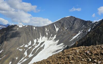
Bedrock studies and soil surveys through geophysics are useful in helping to map geologic features. This includes things like fractures, joints, faults, changes in topography, and more.
EXAMPLES OF GEOPHYSICAL SERVICES
Geophysical services typically contain a range of data collection, analysis, and reporting. The surveys used depend on the land and the project goals. Common surveys include:
- Resistivity and Induced Polarity (IP) – This measures the electrical properties of subsurface rock. This assists in mineral, geothermal, and groundwater exploration.
- Gravity – This survey measures changes in the earth’s gravitational field caused by variations in the density of the subsurface, including faults, voids, bedrock topography, and basin geometry.
- Magnetics (Mag) – Magnetic survey helps to identify anomalies in the earth’s magnetic field. This can help to identify mineral-bearing ore bodies and subsurface structure.
- Seismic – Seismic surveys can be conducted onshore (land) and offshore (marine). They generate images of the earth’s subsurface using seismic refraction or reflection, helping to assist in planning exploration and development.
- Ground Penetrating Radar (GPR) – GPR uses radar pulses to image the subsurface by detecting reflected signals from the subsurface structures. This can help with prospecting, borehole structure mapping, and more.
- Time Domain Electromagnetics (TDEM) – This helps to determine subsurface electrical properties. They are also sensitive to subsurface magnetic properties. This is a very common surface EM technique for mineral exploration in both onshore and offshore applications.
- Frequency Domain Electromagnetics (FDEM) – FDEM measures voltages induced when exposed to a varying magnetic field. It is used for identifying transitions in soil type, detecting geological features, mapping, and more.
- Very Low Frequency (VLF) – VLF survey methods use very-low-frequency radio communication signals to determine electrical properties of the shallow subsurface. This is a good tool for quickly and inexpensively identifying target areas for further investigation.
- Gamma Ray Spectrometer – Gamma-ray spectrometry surveys map the natural occurrence of Potassium, uranium, and thorium within rock. These produce heat through radioactive decay. This can be a helpful tool for geological mapping of rock alteration and concentration of radioactive elements.
- Controlled Source Audio-frequency Magnetotellurics (CSAMT) – This low-impact survey method transmits an eclectic signal into the ground from one location and measures the received electric and magnetic fields. This helps to provide information about geologic structure, locations for mineral investigations, and more.
- Natural Source Audio-frequency Magnetotellurics (AMT) – AMT surveying uses naturally occurring passive energy sources to map geologic structures. This survey is particularly helpful in investigating deep structures.
LEARN MORE
Are you interested in learning more about geophysical services or how they can help with your mining or geology project? Contact Rangefront today to talk with one of our geophysics experts.

ABOUT THE AUTHOR
BRIAN GOSS
President, Rangefront Mining Services
Brian Goss brings over 20 years of experience in gold and mineral exploration. He is the founder and President of Rangefront, a premier geological services and mining consulting company that caters to a large spectrum of clients in the mining and minerals exploration industries. Brian is also a director of Lithium Corp. (OTCQB: LTUM), an exploration stage company specializing in energy storage minerals and from 2014 to 2017, he fulfilled the role of President and Director of Graphite Corp. (OTCQB: GRPH), an exploration stage that specialized in the development of graphite properties. Prior to founding Rangefront, Brian worked as a staff geologist for Centerra Gold on the REN project, as well as various exploration and development projects in the Western United States and Michigan. Brian Goss holds a Bachelor of Science Degree with a major in Geology from Wayne State University in Michigan.
You may also be interested in...
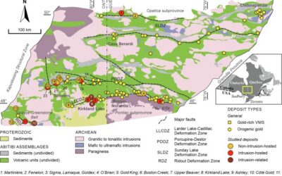
Mineral Exploration in the Abitibi Greenstone Belt: Geology, Deposit Types, and What to Expect in the Field
Image Source: https://www.sciencedirect.com/science/article/abs/pii/S016913682100247X The Abitibi Greenstone Belt produced more gold than almost any other Archean terrane on Earth, and the ground is still generating discovery-stage programs across northern Ontario and...
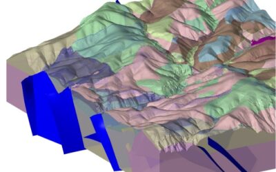
Beyond the Borehole: How 3D Geotechnical Modeling is De-Risking Modern Mine Design
The difference between a viable project and a costly oversight lies in the "digital twin" of the subsurface. Traditional 2D cross-sections, once the industry standard, are no longer sufficient for the complexities of modern resource extraction and the stringent safety...

Starting a Geology Career in Mining and Mineral Exploration
Graduating with a geology degree opens doors, but it can be hard to know which ones to walk through first. Many new graduates want work that's hands-on, technically meaningful, and connected to real projects, but translating that into an actual job search takes some...

Soil Sampling vs. Magnetic vs. Gravity Surveys in Canada’s Covered Terrain
Canada is home to some of the world’s most promising mineral districts, but many of those opportunities lie beneath cover rather than in clean, exposed outcrops. Across much of the country, exploration teams work in terrain shaped by glaciation, transported...

2026 Regulatory Shifts in Geophysics & Geotechnical Reporting in Canada
For Canadian junior and major exploration firms, the "Qualified Person" (QP) is under more scrutiny than ever. As we move into 2026, the integration of geophysical data into NI 43-101 technical reports has evolved from "supplemental" to "essential." In an era of...
How Geophysical Surveys Support Mineral Exploration in Canada’s Remote and Covered Terrains
Canada is one of the most mineral-rich countries in the world, but much of that potential lies in places that are difficult, expensive, or logistically complex to explore. From vast stretches of the Precambrian Shield to sediment-covered basins and northern regions...

Gravity Surveys in Mineral Exploration: How They Work, What They Reveal, and Why They Matter
In mineral exploration, every decision hinges on understanding what lies beneath the surface before drilling begins. Gravity surveys provide a precise, cost-effective way to map subsurface density variations and uncover geological structures that may host valuable...

Why Magnetic and Gravity Surveys Are Essential for Mineral Exploration in Canada
Canada is one of the most geophysically explored countries in the world. With vast mineral potential spread across the Precambrian Shield, structurally complex greenstone belts, sedimentary basins, and remote northern terrains, Canadian exploration has long relied on...

Magnetic Surveys in Mineral Exploration: How They Work, What They Show, and Why They Matter
Magnetic surveys, commonly known as mag surveys, are one of the most valuable and widely used geophysical tools in mineral exploration. They provide rapid, cost-effective insight into subsurface geology by measuring variations in the Earth’s magnetic field. These...

The 2026 Mining Career Handbook: Roles, Salaries, and How to Build a Future in a Changing Industry
The mining industry has entered a defining decade. As the world transitions toward clean energy and critical mineral demand surges, career opportunities in mining are expanding across every level from field crew operators to geoscientists, engineers, and project...

Free GPR Feasibility Checklist: Is Your Site Suitable for Ground-Penetrating Radar Scanning?
Ground-Penetrating Radar (GPR) is a powerful, non-invasive subsurface imaging tool that plays a critical role in industries ranging from construction and environmental consulting to archaeology and mineral exploration. In mineral exploration and mining, GPR can help...

Mining in British Columbia: Opportunities and Challenges
British Columbia (BC) is one of the world’s most geologically rich and mining-friendly regions. Known for its vast mineral wealth and complex terrain, BC is home to some of Canada’s most productive mining operations. This article explores mining in British Columbia,...