
In mineral exploration, every decision hinges on understanding what lies beneath the surface before drilling begins. Gravity surveys provide a precise, cost-effective way to map subsurface density variations and uncover geological structures that may host valuable mineral deposits. Whether used at the regional scale or in high-resolution project areas, gravity is one of the most dependable geophysical techniques for reducing exploration risk and refining drilling programs.
This guide explains what gravity surveys are, how they work, what they reveal, and how they integrate into a modern exploration workflow.
Quick Links
What is a Gravity Survey
Why Gravity Survey Work
How Gravity Survey Work
What Gravity Surveys Can Identify
Benefits of Gravity Surveys in Mineral Exploration
Ground Gravity vs. Airborne Gravity
How Gravity Surveys Fit Into a Modern Exploration Program
Common Use Cases in Mineral Exploration
Costs: What to Expect
Gravity Surveys vs. Magnetic Surveys
FAQs About Gravity Surveys
What is a Gravity Survey?
A gravity survey is a non-invasive geophysical method used to map subsurface geology by measuring localized variations in the Earth’s gravitational field. These variations, measured in milligals (mGal), are caused by density contrasts () between different rock types, such as dense ore bodies versus lighter sedimentary cover.
Gravity surveys are especially beneficial in regions where electrical or magnetic survey methods are limited by overburden, conductivity, or volcanic cover. In these scenarios, density contrast becomes the most reliable geophysical signal available.
Why Gravity Surveys Works
Gravity surveys operate on a simple physical principle: the gravitational pull measured at the surface increases over denser rocks and decreases over less-dense ones.
- Gravity highs indicate denser rock units. Massive sulfides, magnetite-rich layers, ultramafic intrusions, and certain iron formations create measurable “highs” in gravity data.
- Gravity lows appear over less-dense materials. Unconsolidated sediments, alteration zones, or fractured fault networks often produce gravity lows, helping define structural breaks or basin geometry.
Unlike EM or IP, gravity is not influenced by conductivity, chargeability, or surface moisture. This makes it one of the most stable, noise-resistant geophysical survey methods.
How Gravity Surveys Work
Modern gravity surveys are built around precise instrumentation and meticulous correction workflows. While the data collection may appear straightforward, the strength of gravity as a tool comes from the detailed processing that removes external influences.
1. Planning & Survey Design
Before any fieldwork begins, geophysicists model the survey layout:
- Determine appropriate station spacing based on target scale
- Identify access constraints and topographic challenges
- Select base-station locations to monitor drift
- Fit the survey into the broader geophysical dataset or geological model
Well-designed surveys are tailored to the deposit style, terrain, and budget, ensuring data has enough resolution to be meaningful.
2. Field Data Collection
Field teams visit hundreds or thousands of stations using highly sensitive gravimeters. Each reading is paired with precise GPS elevation data, often accurate to within a few centimeters.
Because gravity measurements drift over time, crews routinely revisit base stations to calibrate the instrument. Most surveys collect multiple repeat readings to ensure the dataset remains internally consistent.
3. Data Corrections & Processing
Raw gravity readings must be corrected for several factors before they reflect true geological variations. These corrections include:
- Earth tides: Large-scale gravitational changes caused by the moon and sun.
- Instrument drift: Gradual sensitivity changes in the gravimeter.
- Latitude and elevation effects: Gravitational pull varies slightly depending on where you stand on Earth.
- Bouguer and terrain corrections
Remove topographic influences so that only density variations remain.
After these corrections, the data is converted into a Bouguer anomaly map, which geophysicists use to interpret subsurface features.
4. Interpretation
Interpreting gravity data requires significant expertise. Geophysicists examine anomalies, gradients, and derivative maps before integrating gravity with magnetics, geology, resistivity, IP, and drilling. The final output often includes 2D or 3D inversion models that guide exploration decisions.
What Gravity Surveys Can Identify
Gravity surveys excel at identifying rock units or ore bodies with density contrasts. Some of the most valuable applications include:
1. Dense Ore Bodies
Dense mineralization is where gravity shines. Massive sulfides, magnetite-rich horizons, chromite layers, and certain skarn systems produce clear, high-amplitude gravity anomalies that are often detectable even beneath substantial cover. This makes gravity a strong tool for targeting at depth.
2. Major Geological Structures
Gravity helps define:
- Fault networks
- Shear zones
- Basin margins
- Intrusive contacts
- Uplifted or down-dropped blocks
These structural interpretations often prove critical when choosing drilling locations or planning follow-up geophysics.
3. Regional Geological Frameworks
At the regional scale, gravity assists with:
- Mapping crustal thickness
- Identifying basin architecture
- Estimating depth to basement
- Understanding large intrusive systems
These insights help exploration teams narrow down areas of interest long before detailed surveys begin.
Benefits of Gravity Surveys in Mineral Exploration
Gravity surveys not only provide cost savings, but they also provide clarity in some of the world’s most complex geological environments.
Cost-Effective for Large Areas
Gravity surveys often require less field time and fewer personnel than EM or seismic survey methods. For regional programs covering hundreds of square kilometers, gravity offers substantial ROI.
Reliable in Difficult Terrains
Conductive clays, dry sands, rugged topography, and volcanic cover rarely degrade gravity data. This robustness is one of the key reasons exploration teams rely on gravity early in a project’s lifecycle.
Ideal for Target Refinement
- Gravity narrows drilling targets by clarifying structure. It outlines intrusive contacts and fault geometries that guide drill placement.
- Gravity fills interpretive gaps left by other geophysical methods. For instance, gravity can distinguish between units with similar magnetic properties.
Integrates Naturally with Other Datasets
Gravity delivers its highest value when combined with:
- Magnetic intensity maps
- Resistivity or IP surveys
- Geological mapping
- Lithological logging
- Structural interpretations
This blended workflow creates a more accurate and defensible exploration model.
Ground Gravity vs. Airborne Gravity
Both survey types measure density, but they serve different roles.
Airborne Gravity
Airborne systems cover large areas quickly, making them ideal for regional mapping in remote terrains. The trade-off is lower resolution, but this is often acceptable during early-stage reconnaissance.
Ground Gravity
Ground surveys offer far greater detail and are the preferred option for project-scale targeting and drill planning. They are more labor-intensive, but the higher resolution can significantly reduce drilling uncertainty.
How Gravity Surveys Fit Into a Modern Exploration Program
Today’s exploration strategies rely on integrated datasets rather than standalone techniques. Gravity surveys typically support three stages of exploration:
1. Regional Screening
Gravity helps identify major intrusions, basin depth, crustal variations, and structural architecture, which are critical information for narrowing down prospective corridors.
2. Project-Scale Targeting
Once promising zones are defined, high-resolution ground gravity clarifies intrusive geometry, structural traps, and potential mineralized bodies. This stage often shapes drill program design.
3. 3D Geological Modeling
Modern inversion software allows gravity data to be merged into detailed 3D geological models, giving geologists deeper insights and more defensible interpretations. This is increasingly important for NI 43-101 and S-K 1300 reporting.
Common Use Cases in Mineral Exploration
- Base metals: Locating dense sulfide accumulations
- Nickel–copper–PGE: Tracking ultramafic feeder systems
- Iron ore: Mapping magnetite/hematite-rich bodies
- Sediment-hosted deposits: Determining basin depth and geometry
- Lithium brines: Identifying basin-controlled aquifers and density gradients
- Structural Mapping: Locating faults, shear zones, and basin boundaries that control mineralization.
- Massive Sulfide Detection: Identifying high-density Copper, Nickel, and Zinc deposits.
- Kimberlite Exploration: Detecting the low-density “pipes” associated with diamond deposits.
Costs: What to Expect
While costs vary by location and survey density, general ranges include:
- Ground gravity: $150–$400 per station
- Airborne gravity: $40–$120 per line-km
- Processing and inversion: Dependent on survey size and model complexity
Even at the higher end of the range, most companies consider gravity to have one of the best ROI profiles in mineral exploration geophysics.
Gravity Surveys vs. Magnetic Surveys
| Feature | Gravity | Magnetics |
| Measures | Density contrast | Magnetic susceptibility |
| Best for | Intrusions, faults, dense ore | Mafic units, iron formations, structure |
| Terrain influence | Minimal | Minimal |
| Resolution | High (ground) | High |
| Limitations | Slower acquisition | Magnetic overprinting |
FAQs About Gravity Surveys
How accurate is a gravity survey?
Modern gravimeters achieve accuracy better than 0.01 mGal, enabling detection of subtle density changes several hundred meters below surface.
Can gravity detect gold?
Directly, no. Gold usually occurs in concentrations too low to change bulk density. However, gravity maps the structural traps (faults and quartz veins) where gold is likely to accumulate.
How deep can gravity surveys see?
Depending on density contrast, gravity can detect major bodies thousands of meters deep.
Do gravity surveys replace drilling?
They guide drilling, not replace it. Gravity reduces risk by clarifying geological structure before expensive drillholes are planned.
What is the difference between ground and airborne gravity?
Ground surveys offer the highest resolution for small, deep targets. Airborne Gravity Gradiometry (AGG) is faster and safer for rugged terrain but has a higher “noise” floor and lower depth penetration for small targets.
Are gravity surveys environmentally safe?
Yes. They are entirely passive, require no ground disturbance, and produce zero emissions or noise beyond the transport to the site.
Final Thoughts
Gravity surveys are one of the most versatile, cost-effective, and interpretively powerful geophysical tools available in mineral exploration. Whether an exploration team is mapping regional structures, modeling intrusive systems, or narrowing down drill targets, gravity delivers insights that improve decision-making and reduce uncertainty. As part of an integrated exploration strategy, gravity remains a cornerstone of successful discovery programs.

ABOUT THE AUTHOR
BRIAN GOSS
President, Rangefront Mining Services
Brian Goss brings over 20 years of experience in gold and mineral exploration. He is the founder and President of Rangefront, a premier geological services and mining consulting company that caters to a large spectrum of clients in the mining and minerals exploration industries. Brian is also a director of Lithium Corp. (OTCQB: LTUM), an exploration stage company specializing in energy storage minerals and from 2014 to 2017, he fulfilled the role of President and Director of Graphite Corp. (OTCQB: GRPH), an exploration stage that specialized in the development of graphite properties. Prior to founding Rangefront, Brian worked as a staff geologist for Centerra Gold on the REN project, as well as various exploration and development projects in the Western United States and Michigan. Brian Goss holds a Bachelor of Science Degree with a major in Geology from Wayne State University in Michigan.
You may also be interested in...
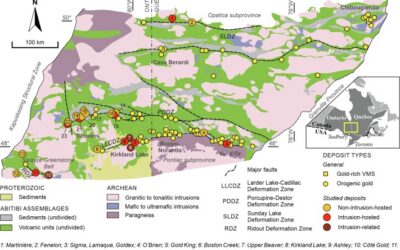
Mineral Exploration in the Abitibi Greenstone Belt: Geology, Deposit Types, and What to Expect in the Field
Image Source: https://www.sciencedirect.com/science/article/abs/pii/S016913682100247X The Abitibi Greenstone Belt produced more gold than almost any other Archean terrane on Earth, and the ground is still generating discovery-stage programs across northern Ontario and...
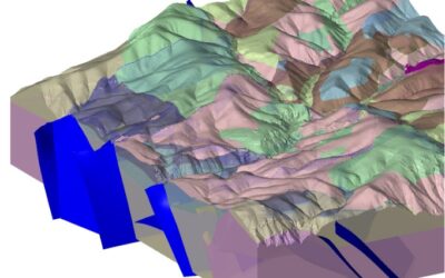
Beyond the Borehole: How 3D Geotechnical Modeling is De-Risking Modern Mine Design
The difference between a viable project and a costly oversight lies in the "digital twin" of the subsurface. Traditional 2D cross-sections, once the industry standard, are no longer sufficient for the complexities of modern resource extraction and the stringent safety...

Starting a Geology Career in Mining and Mineral Exploration
Graduating with a geology degree opens doors, but it can be hard to know which ones to walk through first. Many new graduates want work that's hands-on, technically meaningful, and connected to real projects, but translating that into an actual job search takes some...
Soil Sampling vs. Magnetic vs. Gravity Surveys in Canada’s Covered Terrain
Canada is home to some of the world’s most promising mineral districts, but many of those opportunities lie beneath cover rather than in clean, exposed outcrops. Across much of the country, exploration teams work in terrain shaped by glaciation, transported...

2026 Regulatory Shifts in Geophysics & Geotechnical Reporting in Canada
For Canadian junior and major exploration firms, the "Qualified Person" (QP) is under more scrutiny than ever. As we move into 2026, the integration of geophysical data into NI 43-101 technical reports has evolved from "supplemental" to "essential." In an era of...
How Geophysical Surveys Support Mineral Exploration in Canada’s Remote and Covered Terrains
Canada is one of the most mineral-rich countries in the world, but much of that potential lies in places that are difficult, expensive, or logistically complex to explore. From vast stretches of the Precambrian Shield to sediment-covered basins and northern regions...

Why Magnetic and Gravity Surveys Are Essential for Mineral Exploration in Canada
Canada is one of the most geophysically explored countries in the world. With vast mineral potential spread across the Precambrian Shield, structurally complex greenstone belts, sedimentary basins, and remote northern terrains, Canadian exploration has long relied on...

Magnetic Surveys in Mineral Exploration: How They Work, What They Show, and Why They Matter
Magnetic surveys, commonly known as mag surveys, are one of the most valuable and widely used geophysical tools in mineral exploration. They provide rapid, cost-effective insight into subsurface geology by measuring variations in the Earth’s magnetic field. These...

The 2026 Mining Career Handbook: Roles, Salaries, and How to Build a Future in a Changing Industry
The mining industry has entered a defining decade. As the world transitions toward clean energy and critical mineral demand surges, career opportunities in mining are expanding across every level from field crew operators to geoscientists, engineers, and project...

Free GPR Feasibility Checklist: Is Your Site Suitable for Ground-Penetrating Radar Scanning?
Ground-Penetrating Radar (GPR) is a powerful, non-invasive subsurface imaging tool that plays a critical role in industries ranging from construction and environmental consulting to archaeology and mineral exploration. In mineral exploration and mining, GPR can help...

Mining in British Columbia: Opportunities and Challenges
British Columbia (BC) is one of the world’s most geologically rich and mining-friendly regions. Known for its vast mineral wealth and complex terrain, BC is home to some of Canada’s most productive mining operations. This article explores mining in British Columbia,...

Canada’s Critical Mineral Corridors: What’s Next for Lithium, Cobalt & Rare Earths?
As global industries shift toward decarbonization and clean energy, critical minerals have become the new currency of innovation. From electric vehicles (EVs) to wind turbines and advanced electronics, minerals like lithium, cobalt, and rare earth elements (REEs) are...