
Ground-Penetrating Radar (GPR) is a powerful, non-invasive subsurface imaging tool that plays a critical role in industries ranging from construction and environmental consulting to archaeology and mineral exploration. In mineral exploration and mining, GPR can help delineate subsurface features, assess overburden depth, identify voids, and support pre-drill planning during feasibility studies.
But GPR isn’t a catch-all. Not every site is suitable for radar scanning, and using it in the wrong conditions can lead to misleading or inconclusive data.
That’s why we created this free GPR feasibility checklist: to help you quickly evaluate whether your site has the characteristics needed for a successful radar scan before investing time and resources.
What Is GPR Feasibility and Why Does It Matter?
GPR feasibility refers to whether radar scanning will produce clear, usable data under the physical, geological, and logistical conditions of your site. In mineral exploration and mining, GPR is most often used for shallow subsurface investigations, such as:
- Detecting depth to bedrock or overburden thickness
- Identifying lateral changes in lithology
- Locating subsurface voids or karst features
- Mapping tailings dams or historic mine workings
- Supporting infrastructure layout in disturbed ground
GPR can be a cost-effective complement to drilling in early-stage mineral exploration, site assessments or feasibility studies. However, it is best used when the ground conditions allow high signal clarity and minimal interference. Performing a feasibility review prevents wasted budgets on surveys that won’t yield reliable data.
Key Factors That Determine GPR Feasibility
Our checklist is based on real-world geophysical parameters used in evaluating GPR for mineral sites. Below are the main areas it addresses.
1. Soil and Subsurface Material Types
The single most important variable affecting GPR feasibility is the electrical conductivity and dielectric properties of the subsurface material. High conductivity absorbs the radar signal, drastically reducing its ability to penetrate and return a strong reflection.
- Favorable materials: dry sand, gravel, low-moisture rock, frozen ground
- Problematic materials: wet clay, saline soils, high sulfide content, or mineralized zones with conductive minerals like pyrite or graphite
In mining, this means GPR often works best for weathered rock zones, tailings storage areas, or dry overburden profiles. In contrast, GPR often underperforms in conductive ore bodies or clay-heavy regions.
2. Surface Conditions
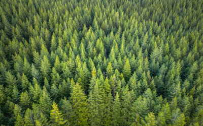
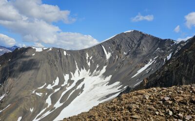
GPR requires good contact with the ground surface. Inaccessible terrain, thick vegetation, snowpack, or rocky outcrops can limit GPR mobility and effectiveness.
- In mining, reclaimed sites or planned drill pads are often cleared and level, making them ideal for rapid GPR coverage.
- In rugged exploration settings, alternative methods like seismic refraction or magnetics surveys may be better suited.
3. Required Depth and Resolution
In mineral exploration, GPR is generally used for shallow subsurface imaging (<10 meters). This includes:
- Detecting shallow mineral veins near the surface
- Estimating overburden thickness above bedrock
- Assessing trench or pit stability before excavation
Lower-frequency antennas (e.g., 100 MHz) can penetrate deeper, but with lower resolution—making it hard to detect small-scale features like fractures or small ore shoots. High-resolution antennas (e.g., 400–900 MHz) give finer detail but are limited to shallower depths (1–3 meters).
Your project goals should determine the appropriate depth/resolution trade-off.
4. Site Size, Accessibility, and Safety
For GPR to work efficiently, the survey area must be accessible by hand-towed or vehicle-mounted systems. In mining operations, this could be:
- Tailings impoundments
- Access roads or haul ramps
- Reclaimed exploration sites
- Mill sites or known historic workings
Access limitations (steep slopes, safety hazards, or waterlogged terrain) can impede data collection or require additional planning.
If your site has restricted access, GPR may still be feasible with drone-mounted systems or smaller modular GPR arrays, options our geophysical team can evaluate for you.
5. Potential Interference Sources
GPR is sensitive to:
- Reinforcing steel (rebar)
- Electrical infrastructure
- Large buried pipes or equipment
- Electromagnetic fields from nearby operations
In active mine sites, nearby generators, high-voltage lines, or buried cables can distort radar signals. Where interference is suspected, combining EM or resistivity surveys may offer better results.
Download the Free GPR Feasibility Checklist
Our detailed, field-tested checklist covers:
- Soil and substrate characteristics
- Surface preparation and topography
- Depth/resolution compatibility
- Physical site constraints
- Potential interference sources
- Use-case context (exploration, monitoring, utility location, etc.)
Whether you’re a site manager, field geologist, environmental consultant, or engineering contractor, this checklist will guide your team through a rapid pre-assessment of your project’s viability for GPR.
How GPR Fits into Mineral Exploration & Feasibility
GPR is rarely used as a standalone exploration tool, but it’s increasingly valued as a target refinement and risk reduction method, especially in:
- Brownfield sites with known shallow workings
- Feasibility-stage projects with infrastructure planning needs
- Permitting phases that require non-invasive documentation of soil conditions
For example:
- GPR can identify subsurface voids or collapses in historic mining districts, reducing risk during development.
- In later phases, GPR helps optimize pit designs, road alignments, or tailings management by mapping bedrock depth or water table proximity.
Our checklist helps clarify where GPR fits in the geophysical workflow and when it should be paired with other methods like seismic, EM, or gravity surveys for more comprehensive modeling.
Not Sure After Reviewing the Checklist? Let’s Talk.
If you’re still uncertain after going through the checklist, don’t hesitate to connect with our team. We offer:
- Free expert review of your completed checklist
- Site-specific recommendations (GPR or alternatives)
- Fast scheduling of field teams for qualified projects
Can GPR detect mineralized zones?
Only in certain cases. GPR is better for identifying geological structures, voids, or boundaries than direct ore detection, especially if the ore has high conductivity (e.g., graphite, pyrite).
Is GPR good for deep imaging?
No. GPR is typically limited to depths of 1–10 meters depending on soil type and antenna frequency. For deeper targets, consider resistivity, seismic, or gravity surveys.
How long does a GPR survey take?
Small sites (<5 acres) can often be scanned in a day. Larger or rough terrain may require more time or specialized equipment.
Can I use GPR before drilling?
Absolutely. GPR is often used to refine drill target placement, avoid hazards, and validate overburden thickness before committing to drill costs.
Final Thoughts
GPR can save time and money when used on the right sites—but knowing whether your location qualifies is the first step. Our free feasibility checklist is designed to make that determination easier, faster, and more accurate for exploration and feasibility-stage projects.
Or send your completed checklist to our team for a free review.

ABOUT THE AUTHOR
BRIAN GOSS
President, Rangefront Mining Services
Brian Goss brings over 20 years of experience in gold and mineral exploration. He is the founder and President of Rangefront, a premier geological services and mining consulting company that caters to a large spectrum of clients in the mining and minerals exploration industries. Brian is also a director of Lithium Corp. (OTCQB: LTUM), an exploration stage company specializing in energy storage minerals and from 2014 to 2017, he fulfilled the role of President and Director of Graphite Corp. (OTCQB: GRPH), an exploration stage that specialized in the development of graphite properties. Prior to founding Rangefront, Brian worked as a staff geologist for Centerra Gold on the REN project, as well as various exploration and development projects in the Western United States and Michigan. Brian Goss holds a Bachelor of Science Degree with a major in Geology from Wayne State University in Michigan.
You may also be interested in...
Soil Sampling vs. Magnetic vs. Gravity Surveys in Canada’s Covered Terrain
Canada is home to some of the world’s most promising mineral districts, but many of those opportunities lie beneath cover rather than in clean, exposed outcrops. Across much of the country, exploration teams work in terrain shaped by glaciation, transported...
How Geophysical Surveys Support Mineral Exploration in Canada’s Remote and Covered Terrains
Canada is one of the most mineral-rich countries in the world, but much of that potential lies in places that are difficult, expensive, or logistically complex to explore. From vast stretches of the Precambrian Shield to sediment-covered basins and northern regions...

Gravity Surveys in Mineral Exploration: How They Work, What They Reveal, and Why They Matter
In mineral exploration, every decision hinges on understanding what lies beneath the surface before drilling begins. Gravity surveys provide a precise, cost-effective way to map subsurface density variations and uncover geological structures that may host valuable...

Why Magnetic and Gravity Surveys Are Essential for Mineral Exploration in Canada
Canada is one of the most geophysically explored countries in the world. With vast mineral potential spread across the Precambrian Shield, structurally complex greenstone belts, sedimentary basins, and remote northern terrains, Canadian exploration has long relied on...

Magnetic Surveys in Mineral Exploration: How They Work, What They Show, and Why They Matter
Magnetic surveys, commonly known as mag surveys, are one of the most valuable and widely used geophysical tools in mineral exploration. They provide rapid, cost-effective insight into subsurface geology by measuring variations in the Earth’s magnetic field. These...

The 2026 Mining Career Handbook: Roles, Salaries, and How to Build a Future in a Changing Industry
The mining industry has entered a defining decade. As the world transitions toward clean energy and critical mineral demand surges, career opportunities in mining are expanding across every level from field crew operators to geoscientists, engineers, and project...

Mining in British Columbia: Opportunities and Challenges
British Columbia (BC) is one of the world’s most geologically rich and mining-friendly regions. Known for its vast mineral wealth and complex terrain, BC is home to some of Canada’s most productive mining operations. This article explores mining in British Columbia,...

Canada’s Critical Mineral Corridors: What’s Next for Lithium, Cobalt & Rare Earths?
As global industries shift toward decarbonization and clean energy, critical minerals have become the new currency of innovation. From electric vehicles (EVs) to wind turbines and advanced electronics, minerals like lithium, cobalt, and rare earth elements (REEs) are...

Environmental Considerations in Canadian Mining: Best Practices
Mining has long been an integral part of Canada’s economy, providing essential minerals and metals that fuel global industries—from construction and energy to technology and transportation. However, mining also presents environmental challenges, including habitat...

Soil Sampling Techniques Used in Mineral Exploration
Soil sampling plays a crucial role in modern mineral exploration. When properly executed, it provides vital geochemical data that helps geologists and exploration companies assess the mineral potential of a target area with greater precision. Various techniques are...

Indigenous Partnerships in Canadian Geophysics: Best Practices for Ethical Exploration
Across Canada, mineral exploration is moving toward greater transparency, accountability, and reconciliation with Indigenous Peoples. As outlined in the Mining Association of Canada’s Towards Sustainable Mining (TSM) protocols, ethical exploration now requires early,...

Annual Claim Renewals: Mining Claim Maintenance & Assessment Information
Late summer is a critical time for the mining and exploration industry. The deadline for Annual Mining Claim Renewals is September 1, and it arrives fast. Whether you’re a small-scale prospector or managing dozens of claims, it’s essential to ensure your filings,...