
Across Canada, mineral exploration is moving toward greater transparency, accountability, and reconciliation with Indigenous Peoples. As outlined in the Mining Association of Canada’s Towards Sustainable Mining (TSM) protocols, ethical exploration now requires early, meaningful engagement with Indigenous communities.
Geophysical surveys, while often non-invasive, must be approached with cultural sensitivity and collaborative intent. In this article, we explore best practices for Indigenous partnerships in geophysics and show how these approaches align with TSM guidelines and ESG expectations.
Why Indigenous Partnerships Are Essential in Geophysical Exploration
Canada’s mineral-rich geography overlaps significantly with Indigenous territory. In fact, over 50% of prospective mining lands lie within areas that are subject to Indigenous land claims, traditional territories, or treaty rights. This reality carries not only legal implications but also ethical ones.
Regulatory frameworks such as Canada’s Impact Assessment Act (2019), provincial duty-to-consult policies, and the growing influence of Indigenous governance mean that exploration firms must now engage communities early, meaningfully, and transparently. Failure to do so risks legal delays as well as damage to corporate reputation and long-term project viability.
From an Environmental, Social, and Governance (ESG) standpoint, investors are increasingly demanding proof of socially responsible practices, especially where Indigenous rights are concerned. Community buy-in is becoming a fundamental metric of a project’s sustainability and social license to operate.
Principles of Ethical and Culturally Sensitive Mineral Exploration
Ethical exploration begins with acknowledgment of land, of culture, and of community priorities. It continues through co-development, ongoing dialogue, and equitable participation. Below are key principles guiding ethical geophysical work in Indigenous territories.
1. Free, Prior, and Informed Consent (FPIC)
FPIC is a foundational concept under the United Nations Declaration on the Rights of Indigenous Peoples (UNDRIP), which Canada has committed to implementing. While GPR or seismic surveys may not be as visibly disruptive as drilling or excavation, they still carry symbolic and territorial implications.
Consent must be sought before initiating survey design, not after permits are secured. This includes clearly explaining what the survey entails, where it will occur, what data it will gather, and how the results will be used. Consent must be given freely, without coercion, and with full understanding of the implications.
2. Respect for Sacred Sites and Traditional Knowledge
Not all land is the same. What may appear as “unused” terrain to a geophysical crew may in fact be a sacred site, an ancestral trail, or a traditional hunting ground.
Respecting this knowledge requires active listening. Indigenous knowledge holders can contribute valuable insight into seasonal cycles, safe travel routes, and areas that should be avoided entirely. This is not only a respectful practice but can also improve the safety and accuracy of surveys.
3. Transparent Communication and Shared Decision-Making
Too often, exploration firms approach consultation as a one-time obligation. Ethical engagement is continuous and reciprocal. Survey maps, equipment plans, and expected impacts should be shared in understandable formats, not just technical documentation.
Moreover, community input should be integrated. Considerations like school schedules, hunting seasons, or spiritual observances may affect survey timing. Incorporating these factors shows respect and builds trust.
Models of Co-Development in Geophysical Work
True partnership invites collaboration from the outset. Co-development models in geophysical work can include:
- Integrating community environmental monitors during data collection
- Sharing and interpreting data jointly, with access provided in plain language or visual formats
- Creating revenue-sharing or capacity-building arrangements, including co-branding final reports
In many regions, federal and provincial governments now offer incentives and funding for Indigenous engagement. For example:
- Natural Resources Canada’s Indigenous Natural Resource Partnerships Program supports skills development and partnerships.
- Ontario’s Junior Exploration Assistance (OJEA) program requires documentation of Indigenous engagement as part of funding applications.
- British Columbia offers Economic Development Grants to support First Nations participating in natural resource projects.
These mechanisms not only reduce project risk but can also significantly strengthen long-term exploration success.
How Ethical Exploration Aligns with ESG Goals and Grant Criteria
ESG reporting standards now demand more than simple acknowledgment of Indigenous presence. Social metrics such as inclusive hiring, transparent consultation, benefit-sharing, and ethical data management are becoming essential criteria for exploration investment.
Institutional investors and project funders are increasingly scrutinizing how companies build community partnerships not only to mitigate conflict but to reward leadership in reconciliation and sustainability.
Additionally, government grants and exploration support funds now routinely require documentation of Indigenous engagement strategies. Companies that demonstrate co-developed approaches to environmental baselines, exploration planning, and geophysical survey execution are more likely to secure funding and receive favorable permitting outcomes.
Final Thoughts
Ethical exploration is now a foundational part of mineral exploration in Canada. In the context of geophysical work, this means treating Indigenous communities not as external stakeholders, but as equity partners in knowledge, stewardship, and opportunity.
When exploration companies listen early, design surveys collaboratively, and share both information and benefits, the result is a better, more sustainable foundation for the future of mining in Canada.

ABOUT THE AUTHOR
BRIAN GOSS
President, Rangefront Mining Services
Brian Goss brings over 20 years of experience in gold and mineral exploration. He is the founder and President of Rangefront, a premier geological services and mining consulting company that caters to a large spectrum of clients in the mining and minerals exploration industries. Brian is also a director of Lithium Corp. (OTCQB: LTUM), an exploration stage company specializing in energy storage minerals and from 2014 to 2017, he fulfilled the role of President and Director of Graphite Corp. (OTCQB: GRPH), an exploration stage that specialized in the development of graphite properties. Prior to founding Rangefront, Brian worked as a staff geologist for Centerra Gold on the REN project, as well as various exploration and development projects in the Western United States and Michigan. Brian Goss holds a Bachelor of Science Degree with a major in Geology from Wayne State University in Michigan.
You may also be interested in...

Annual Claim Renewals Updated for 2026: Mining Claim Maintenance & Assessment Information
Late summer is a critical time for the mining and exploration industry. The deadline for Annual Mining Claim Renewals is September 1, and it arrives fast. Whether you’re a small-scale prospector or managing dozens of claims, it’s essential to ensure your filings,...
Combining Drone and Ground Mag Surveys: More Data, Less Time in the Field
A magnetic survey is only as good as the data density behind it. Two survey platforms, flown and walked over the same ground on the same program, can double that density without doubling your budget or your schedule. That is the logic behind Rangefront's approach to...
Yukon Geophysical Surveys: Season Planning and Field Logistics
The Yukon exploration season is shorter than most project managers account for, and the margin for a poorly timed mobilization is close to zero. Between spring break-up, permafrost thaw cycles, and the onset of fall freeze, the usable field window for most ground...
How to Read an IP Pseudosection: Interpreting Chargeability and Resistivity Anomalies Before You Drill
A chargeability anomaly that looks like a porphyry target and turns out to be graphitic shale is a wasted drill hole, a budget hit, and a credibility problem in front of your board. Reading an IP pseudosection correctly before the rig mobilizes is one of the...
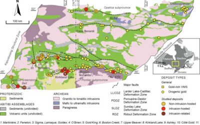
Mineral Exploration in the Abitibi Greenstone Belt: Geology, Deposit Types, and What to Expect in the Field
Image Source: https://www.sciencedirect.com/science/article/abs/pii/S016913682100247X The Abitibi Greenstone Belt produced more gold than almost any other Archean terrane on Earth, and the ground is still generating discovery-stage programs across northern Ontario and...
Beyond the Borehole: How 3D Geotechnical Modeling is De-Risking Modern Mine Design
The difference between a viable project and a costly oversight lies in the "digital twin" of the subsurface. Traditional 2D cross-sections, once the industry standard, are no longer sufficient for the complexities of modern resource extraction and the stringent safety...

Starting a Geology Career in Mining and Mineral Exploration
Graduating with a geology degree opens doors, but it can be hard to know which ones to walk through first. Many new graduates want work that's hands-on, technically meaningful, and connected to real projects, but translating that into an actual job search takes some...

Soil Sampling vs. Magnetic vs. Gravity Surveys in Canada’s Covered Terrain
Canada is home to some of the world’s most promising mineral districts, but many of those opportunities lie beneath cover rather than in clean, exposed outcrops. Across much of the country, exploration teams work in terrain shaped by glaciation, transported...

2026 Regulatory Shifts in Geophysics & Geotechnical Reporting in Canada
For Canadian junior and major exploration firms, the "Qualified Person" (QP) is under more scrutiny than ever. As we move into 2026, the integration of geophysical data into NI 43-101 technical reports has evolved from "supplemental" to "essential." In an era of...
How Geophysical Surveys Support Mineral Exploration in Canada’s Remote and Covered Terrains
Canada is one of the most mineral-rich countries in the world, but much of that potential lies in places that are difficult, expensive, or logistically complex to explore. From vast stretches of the Precambrian Shield to sediment-covered basins and northern regions...

Gravity Surveys in Mineral Exploration: How They Work, What They Reveal, and Why They Matter
In mineral exploration, every decision hinges on understanding what lies beneath the surface before drilling begins. Gravity surveys provide a precise, cost-effective way to map subsurface density variations and uncover geological structures that may host valuable...

Why Magnetic and Gravity Surveys Are Essential for Mineral Exploration in Canada
Canada is one of the most geophysically explored countries in the world. With vast mineral potential spread across the Precambrian Shield, structurally complex greenstone belts, sedimentary basins, and remote northern terrains, Canadian exploration has long relied on...