If you are new to the metals industry; whether that be in exploration or production, you have probably come across or used a Certified Reference Material (CRM), also known as a “standard.” Standards are used in a wide variety of applications and for a variety of purposes, including for instrument calibration in labs or as a reference with which to compare other unknown values. This is where the geochemical reference material comes in as a comparative value for assay or other geochemical reports.
WHAT IS A “STANDARD” IN MINING GEOLOGY?
In the world of mining geology, there are many terms that are used to refer to Geochemical Reference Materials (GRM). Commonly used terms include: “standard,” “CRM” or Certified Reference Material, and “SRM” or Standard Reference Material.
Technically, the little packets of rock powder used in the metals industry for Quality Assurance (QA) and Quality Control (QC) programs are considered geochemical reference materials. Geochemical reference materials, or GRM, are sourced from natural material such as minerals, ore, or rock that can be sufficiently homogenized and are available in sufficient quantity to produce a “standard” to be used in geochemical analysis of similar minerals, ores, or rocks of unknown concentration.
By contrast, a certified reference material (CRM) is certified to fall within 10% of the published value and are materials used in laboratories to calibrate analytical equipment. Although this level of precision is not necessary for a reference material included as a known control in a batch of unknown samples, GRM makers often produce materials that are either considered “certified” or “provisional,” which have a relative standard deviation of 0<5% or 5<15%, respectively.
HOW DOES A GEOCHEMICAL REFERENCE STANDARD AID IN METALS EXPLORATION AND PRODUCTION?
Every research project regardless of topic has a control group—a set of subjects whose parameters are known. The controls, in this case GRM, provide an established parameter for the concentrations of a particular element in question, which allows the end user a means to compare the results of unknown samples.
In other words, if a batch of samples being prospected for metals are submitted to an assay lab, the assay lab will then crush, grind, digest and analyze those samples using that lab’s established protocols. The lab will then provide the client a set of data, including the concentration of the target metal for each sample.
How do we know those values are correct? This is where an end-user standard (GRM) comes into play. By comparing the value reported by the lab with the value that material is certified to contain, the client can tell if the values reported for their unknown samples are accurate. This provides a checks-and-balances of sorts on procedures and data produced by a lab as well as the data an exploration or production company reports to the public by way of a National Instrument 43-101, technical report.
For exploration programs that are delineating a resource, full quality control procedures are required by securities regulators to be applied and listed in a technical report. A quality control program includes means to assess the accuracy, precision, and possible contamination in the process of analysing samples used in a resource estimate. Geological reference materials (standards) and geochemically blank materials (blanks) are part of the standard procedures used to monitor accuracy and contamination.
Geochemical standards should contain metal grades within the ballpark of the grades anticipated for a particular program. Generally, a lower concentration standard would be chosen for green projects. For more advanced projects with a known ore zone, grades should closely match those known to be encountered.
Matrix should also be considered when selecting a standard. If a project is likely to contain silica encapsulated gold or other metals, a standard made from a naturally silica rich material or similar style deposit is a better comparison for the project samples. Likewise, a standard analyzed by the same procedure in the round robin (certification process) that unknown samples will be analyzed is critical to having accurate results returned in a quality control program. For advanced programs in the development or production stage, it may be most ideal and cost effective for a standard to be made for that specific project from the known ore horizon(s).
ABOUT THE AUTHOR
AJEET MILLARD
Owner, MEG, LLC.
This guest blog was written by Ajeet Milliard, owner of MEG, LLC. MEG, or Moment Exploration Company, provides quality geochemistry services, products and tools to the global precious metal and environmental industries. MEG is located in Lamoille, Nevada and is one of few mining-related businesses that is female owned. With a combined 25-year history of services and experience in the metals industry, MEG offers unparalleled expertise in providing quality Reference Materials (RM) and geochemical analysis.
Learn more about MEG, LLC online at:
You may also be interested in…

Annual Claim Renewals Updated for 2026: Mining Claim Maintenance & Assessment Information
Late summer is a critical time for the mining and exploration industry. The deadline for Annual Mining Claim Renewals is September 1, and it arrives fast. Whether you’re a small-scale prospector or managing dozens of claims, it’s essential to ensure your filings,...
Combining Drone and Ground Mag Surveys: More Data, Less Time in the Field
A magnetic survey is only as good as the data density behind it. Two survey platforms, flown and walked over the same ground on the same program, can double that density without doubling your budget or your schedule. That is the logic behind Rangefront's approach to...
Yukon Geophysical Surveys: Season Planning and Field Logistics
The Yukon exploration season is shorter than most project managers account for, and the margin for a poorly timed mobilization is close to zero. Between spring break-up, permafrost thaw cycles, and the onset of fall freeze, the usable field window for most ground...
How to Read an IP Pseudosection: Interpreting Chargeability and Resistivity Anomalies Before You Drill
A chargeability anomaly that looks like a porphyry target and turns out to be graphitic shale is a wasted drill hole, a budget hit, and a credibility problem in front of your board. Reading an IP pseudosection correctly before the rig mobilizes is one of the...
Mineral Exploration in the Abitibi Greenstone Belt: Geology, Deposit Types, and What to Expect in the Field
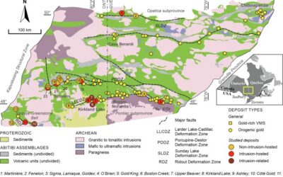
Image Source: https://www.sciencedirect.com/science/article/abs/pii/S016913682100247X The Abitibi Greenstone Belt produced more gold than almost any other Archean terrane on Earth, and the ground is still generating discovery-stage programs across northern Ontario and...
Beyond the Borehole: How 3D Geotechnical Modeling is De-Risking Modern Mine Design
The difference between a viable project and a costly oversight lies in the "digital twin" of the subsurface. Traditional 2D cross-sections, once the industry standard, are no longer sufficient for the complexities of modern resource extraction and the stringent safety...

Starting a Geology Career in Mining and Mineral Exploration
Graduating with a geology degree opens doors, but it can be hard to know which ones to walk through first. Many new graduates want work that's hands-on, technically meaningful, and connected to real projects, but translating that into an actual job search takes some...

Soil Sampling vs. Magnetic vs. Gravity Surveys in Canada’s Covered Terrain
Canada is home to some of the world’s most promising mineral districts, but many of those opportunities lie beneath cover rather than in clean, exposed outcrops. Across much of the country, exploration teams work in terrain shaped by glaciation, transported...

2026 Regulatory Shifts in Geophysics & Geotechnical Reporting in Canada
For Canadian junior and major exploration firms, the "Qualified Person" (QP) is under more scrutiny than ever. As we move into 2026, the integration of geophysical data into NI 43-101 technical reports has evolved from "supplemental" to "essential." In an era of...
How Geophysical Surveys Support Mineral Exploration in Canada’s Remote and Covered Terrains
Canada is one of the most mineral-rich countries in the world, but much of that potential lies in places that are difficult, expensive, or logistically complex to explore. From vast stretches of the Precambrian Shield to sediment-covered basins and northern regions...

Gravity Surveys in Mineral Exploration: How They Work, What They Reveal, and Why They Matter
In mineral exploration, every decision hinges on understanding what lies beneath the surface before drilling begins. Gravity surveys provide a precise, cost-effective way to map subsurface density variations and uncover geological structures that may host valuable...

Why Magnetic and Gravity Surveys Are Essential for Mineral Exploration in Canada
Canada is one of the most geophysically explored countries in the world. With vast mineral potential spread across the Precambrian Shield, structurally complex greenstone belts, sedimentary basins, and remote northern terrains, Canadian exploration has long relied on...