
For Canadian junior and major exploration firms, the “Qualified Person” (QP) is under more scrutiny than ever. As we move into 2026, the integration of geophysical data into NI 43-101 technical reports has evolved from “supplemental” to “essential.” In an era of high-stakes investment, Rangefront’s Canadian operations are bridging the gap between raw field data and investor-ready reporting, ensuring that resource estimates are backed by high-resolution subsurface imaging.
The Evolution of NI 43-101 Standards
Recent updates in Canadian reporting standards emphasize geological confidence. It is no longer enough to report grade and tonnage; the QP must demonstrate a deep understanding of the structural controls of the deposit.
- Geophysical Constraints: Using Induced Polarization (IP) and Magnetics to define the “plumbing” of a mineral system.
- Reducing “Inferred” Risks: Strategic geophysics allows companies to move resources from “Inferred” to “Indicated” categories with fewer holes, saving millions in drilling costs while satisfying regulators.
Regional Focus
The Canadian landscape varies wildly, from the deep-seated greenstone belts of the Abitibi to the sedimentary basins of the Prairie provinces. Rangefront tailors its geophysical methods to the specific “signature” of the target.
- Abitibi Gold: High-resolution mag and IP to find the subtle shear zones.
- Critical Minerals (Ontario/Quebec): Utilizing electromagnetic (EM) surveys to identify the conductive signatures of nickel and copper-rich sulfides.
The Role of Indigenous Partnerships
Modern exploration in Canada is inseparable from First Nations engagement. Technical transparency is a key pillar of this relationship. By utilizing non-invasive geophysics, Rangefront helps clients share “what’s under the ground” with community stakeholders without the visual and environmental impact of trenching. This builds “Social License” through data-sharing and respect for the land.
Reach Out
For more information about our geotechnical and geophysical services in Canada, please reach out.

ABOUT THE AUTHOR
BRIAN GOSS
President, Rangefront Mining Services
Brian Goss brings over 20 years of experience in gold and mineral exploration. He is the founder and President of Rangefront, a premier geological services and mining consulting company that caters to a large spectrum of clients in the mining and minerals exploration industries. Brian is also a director of Lithium Corp. (OTCQB: LTUM), an exploration stage company specializing in energy storage minerals and from 2014 to 2017, he fulfilled the role of President and Director of Graphite Corp. (OTCQB: GRPH), an exploration stage that specialized in the development of graphite properties. Prior to founding Rangefront, Brian worked as a staff geologist for Centerra Gold on the REN project, as well as various exploration and development projects in the Western United States and Michigan. Brian Goss holds a Bachelor of Science Degree with a major in Geology from Wayne State University in Michigan.
You may also be interested in...

Annual Claim Renewals Updated for 2026: Mining Claim Maintenance & Assessment Information
Late summer is a critical time for the mining and exploration industry. The deadline for Annual Mining Claim Renewals is September 1, and it arrives fast. Whether you’re a small-scale prospector or managing dozens of claims, it’s essential to ensure your filings,...
Combining Drone and Ground Mag Surveys: More Data, Less Time in the Field
A magnetic survey is only as good as the data density behind it. Two survey platforms, flown and walked over the same ground on the same program, can double that density without doubling your budget or your schedule. That is the logic behind Rangefront's approach to...
Yukon Geophysical Surveys: Season Planning and Field Logistics
The Yukon exploration season is shorter than most project managers account for, and the margin for a poorly timed mobilization is close to zero. Between spring break-up, permafrost thaw cycles, and the onset of fall freeze, the usable field window for most ground...
How to Read an IP Pseudosection: Interpreting Chargeability and Resistivity Anomalies Before You Drill
A chargeability anomaly that looks like a porphyry target and turns out to be graphitic shale is a wasted drill hole, a budget hit, and a credibility problem in front of your board. Reading an IP pseudosection correctly before the rig mobilizes is one of the...
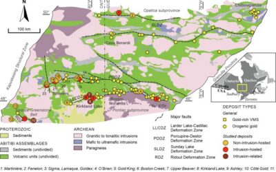
Mineral Exploration in the Abitibi Greenstone Belt: Geology, Deposit Types, and What to Expect in the Field
Image Source: https://www.sciencedirect.com/science/article/abs/pii/S016913682100247X The Abitibi Greenstone Belt produced more gold than almost any other Archean terrane on Earth, and the ground is still generating discovery-stage programs across northern Ontario and...
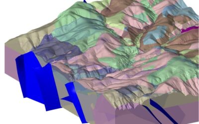
Beyond the Borehole: How 3D Geotechnical Modeling is De-Risking Modern Mine Design
The difference between a viable project and a costly oversight lies in the "digital twin" of the subsurface. Traditional 2D cross-sections, once the industry standard, are no longer sufficient for the complexities of modern resource extraction and the stringent safety...

Starting a Geology Career in Mining and Mineral Exploration
Graduating with a geology degree opens doors, but it can be hard to know which ones to walk through first. Many new graduates want work that's hands-on, technically meaningful, and connected to real projects, but translating that into an actual job search takes some...

Soil Sampling vs. Magnetic vs. Gravity Surveys in Canada’s Covered Terrain
Canada is home to some of the world’s most promising mineral districts, but many of those opportunities lie beneath cover rather than in clean, exposed outcrops. Across much of the country, exploration teams work in terrain shaped by glaciation, transported...
How Geophysical Surveys Support Mineral Exploration in Canada’s Remote and Covered Terrains
Canada is one of the most mineral-rich countries in the world, but much of that potential lies in places that are difficult, expensive, or logistically complex to explore. From vast stretches of the Precambrian Shield to sediment-covered basins and northern regions...

Gravity Surveys in Mineral Exploration: How They Work, What They Reveal, and Why They Matter
In mineral exploration, every decision hinges on understanding what lies beneath the surface before drilling begins. Gravity surveys provide a precise, cost-effective way to map subsurface density variations and uncover geological structures that may host valuable...

Why Magnetic and Gravity Surveys Are Essential for Mineral Exploration in Canada
Canada is one of the most geophysically explored countries in the world. With vast mineral potential spread across the Precambrian Shield, structurally complex greenstone belts, sedimentary basins, and remote northern terrains, Canadian exploration has long relied on...

Magnetic Surveys in Mineral Exploration: How They Work, What They Show, and Why They Matter
Magnetic surveys, commonly known as mag surveys, are one of the most valuable and widely used geophysical tools in mineral exploration. They provide rapid, cost-effective insight into subsurface geology by measuring variations in the Earth’s magnetic field. These...