Geological Services and Field Crews Across Canada
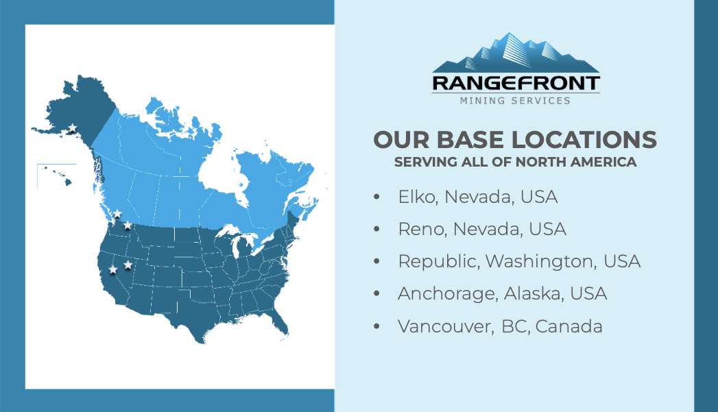
Canada holds some of the most productive mineral ground on earth, and most of it is genuinely hard to reach. The Athabasca Basin, the Abitibi Greenstone Belt, the Stikine Terrane, the Tintina Gold Belt: these are not places where a crew with limited remote logistics experience can show up and run a clean program. Rangefront Mining Services operates across Canada with the Vancouver, BC office as the Canadian base, backed by over a decade of field execution in exactly this kind of terrain.
Rangefront provides geological services, geophysical survey programs, field crew support, and technical reporting for mineral exploration and mining projects across all major Canadian provinces and territories. Whether your program is a single-season soil sampling campaign in BC's Interior or a multi-method geophysical program on the Canadian Shield, the work is designed and managed by people who have executed field programs under the same logistical pressures your team is facing.
Request a Project Quote from Vancouver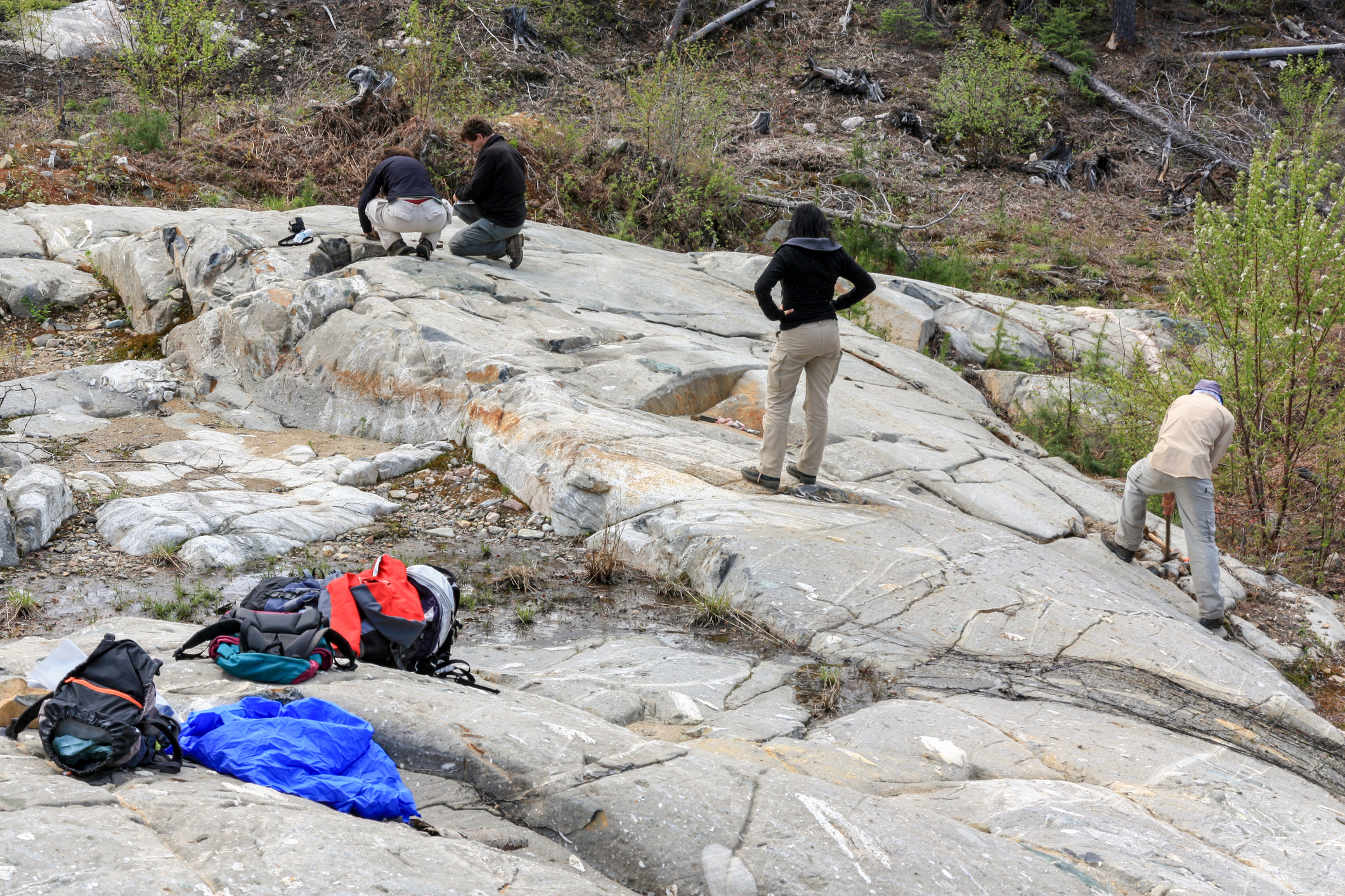
8
Provinces and territories
served across Canada
10+
Years of Canadian field
program execution
7
Geophysical methods
deployable in Canada
3
Reporting standards:
NI 43-101, S-K 1300, JORC
What Geological and Mining Services Mean in Canada
Mineral exploration in Canada operates under a distinct regulatory and environmental framework. NI 43-101 technical reports govern the public disclosure of mineral resource and reserve estimates for TSX and TSX-V listed companies. First Nations consultation requirements vary by province and territory and carry real timeline implications. Environmental permitting thresholds differ between BC, Ontario, Quebec, and the northern territories. A contractor operating across this environment needs more than technical competence: they need familiarity with the specific compliance requirements in the region where your project sits.
Rangefront's Canadian operations are structured around three service categories: geophysical surveys, field crew services, and technical services. Each is delivered by personnel who understand how the work product feeds into the next stage of your exploration program, whether that is a drill permit application, an NI 43-101 resource estimate, or a project presentation to a TSX-V board.
Geophysical Surveys
IP and resistivity, gravity, ground magnetics, UAV drone magnetics, CSAMT, FDEM, and ground GPR. Method selection is calibrated to deposit type, depth range, and terrain access.
Field Crew Services
Claim staking, soil and rock chip sampling, annual claim renewal, and AML hazard fencing. Executed under the same QC framework as the geophysical programs.
Technical Services
NI 43-101 technical reporting, 3D geological modeling, mineral exploration support, and geological consulting. Report structure and data verification follow current NI 43-101 form.
How Rangefront Approaches Canadian Programs
Every Canadian program starts with a scoping conversation, not a rate card. The questions that matter before mobilizing a crew to northern BC or the Yukon are logistical and geological: What is the access situation in early season versus mid-season? Is there an active permit, or does the program need to be designed around existing authorizations? What are the primary target types, and which geophysical methods are geometrically appropriate for the depth range and structural orientation of the mineralization?
01
Scoping Conversation
Access conditions, permit status, target type, and required data deliverables are established before any mobilization cost is incurred. Helicopter payload limits and seasonal windows are factored in at this stage.
02
Program Design
Survey geometry, array selection, and QC protocols are defined against the deposit model. For remote programs, equipment manifests are built with portability as a hard constraint.
03
Field Execution
GPS-verified sample locations, chain-of-custody documentation, and instrument calibration records are applied from day one. Raw data files are retained in native formats alongside processed deliverables.
04
Interpreted Deliverables
Processed data, inversion models, anomaly rankings, drill collar recommendations, and section-level interpretation are delivered in formats compatible with Geosoft Oasis Montaj and standard geological modeling workflows.
Field QC protocols matter most on projects that feed into an NI 43-101 technical report or a resource estimation workflow. Programs are documented with that downstream requirement in mind from the start, not retrofitted after the fact.
Where Canadian Programs Concentrate
Canada's mineral endowment is diverse, and the service mix Rangefront deploys shifts by region and target type. The six regions below represent the primary operating areas for Rangefront's geophysical survey and field crew services in Canada.
BC & Stikine Terrane
Gold-copper porphyry country. Programs combine induced polarization surveys for chargeability response in sulfide-bearing alteration zones with UAV magnetics for structural mapping. Terrain ranges from valley-bottom claims to high-alpine programs requiring helicopter support.
Yukon & Tintina Gold Belt
Orogenic gold, sediment-hosted gold, and porphyry Cu-Au systems at depth. Gravity surveys for density contrast alongside IP and magnetics. Short field seasons, wet tundra access, and wildlife management guidelines all factor into program design.
Abitibi Greenstone Belt
Canada's most active VMS and orogenic gold belts. IP surveys for sulfide detection, CSAMT for deeper resistivity structure in volcanic-hosted targets, and ground magnetics for iron formation mapping. Programs typically run from road-accessible bases.
Athabasca Basin
Unconformity-associated uranium. Stratigraphic and structural controls on mineralization are well-defined. Geophysical methods and survey geometries are selected for basement conductor and unconformity target programs.
Newfoundland & Labrador
Renewed exploration interest in gold, copper, and nickel targets on the Grenville Province and the Appalachian margin. Access varies from road-supported coastal programs to interior fly-in logistics.
Northwest Territories
Diamond, gold, and base metal targets in remote terrain. Program planning accounts for short working seasons, limited resupply windows, and territorial permitting timelines that must be met to capture the seasonal window.
Key Technical Parameters and Deliverables
The deliverable set for a Canadian program depends on which service or services are engaged. Standard outputs for each category are listed below.
| Service | Standard Deliverables |
|---|---|
| Geophysical Surveys | Gridded data files (.grd) and profile data files (.dat) in Geosoft Oasis Montaj-compatible formats. 2D inversion models with documented parameters and convergence statistics run using Res2DInv or ZondRes2D. Volumetric 3D inversion models where program scope requires. UAV magnetic deliverables include leveled, IGRF-corrected total magnetic intensity grids plus tilt-angle and first vertical derivative products. Formats: .grd, .dat, georeferenced PDF sections, written report with depth-of-investigation discussion |
| Field Crew Services | GPS-verified sample location files, completed chain-of-custody logs, and summary tables formatted for laboratory dispatch. Annual claim renewal and claim staking deliverables follow the requirements of the relevant provincial or territorial mining legislation. Standards: provincial and territorial Mining Act requirements; NI 43-101-ready documentation on request |
| NI 43-101 Technical Reporting | Technical reports prepared in accordance with National Instrument 43-101 (Canada), with report structure, data verification, and disclaimer language following current NI 43-101 form and Canadian Securities Administrators guidelines. S-K 1300 (SEC) and JORC Code reporting are also available for cross-listed or dual-listed projects. Standards: NI 43-101, S-K 1300 (SEC), JORC Code |
| 3D Geological Modeling | Volumetric geological models built from drill data, surface mapping, and geophysical inversion outputs. Delivered in formats suitable for input into resource estimation workflows. Compatible with standard geological modeling platforms; confirm format requirements at scoping |
For IP and resistivity programs, 2D inversion sections are delivered with an honest discussion of depth of investigation and resolution limits. A chargeability section that claims resolution at depths beyond what the array geometry supports is a liability in any NI 43-101 disclosure context. Rangefront's interpreted deliverables document those limits explicitly.
Terrain and Coverage: Logistical Realities
Canada is a logistically complex operating environment. The accessible field season in the Yukon and NWT runs roughly from June through September, with river and tundra conditions determining actual mobilization windows in any given year. BC programs can run longer depending on elevation and snowpack. Ontario and Quebec offer the longest accessible seasons but introduce water crossings and variable ground conditions that affect wheeled equipment access.
Fly-in programs require advance coordination with charter operators, and equipment manifests must be built with helicopter payload limits as a hard constraint. Rangefront's equipment inventory for remote programs is configured with portability in mind. Geophysical instruments are set up for backpack or helicopter-sling deployment where road access ends.
The Shield terrain in Ontario and Quebec introduces specific challenges for resistivity methods: thin overburden over outcrop produces highly variable electrode coupling, and water crossings affect line layout. These are known constraints, and survey design accounts for them. Programs are not designed on paper and then corrected in the field.
Rangefront's Canadian coverage includes British Columbia, Yukon, Northwest Territories, Alberta, Saskatchewan, Ontario, Quebec, and Newfoundland and Labrador. Programs in any of these jurisdictions are managed from the Vancouver office at Suite 401, 353 Water Street. If your program sits in a jurisdiction or terrain type not listed here, contact the Vancouver office to discuss feasibility before assuming coverage is unavailable.
§ 08 Why Rangefront for Canadian Programs
10+
Years of Canadian field program execution across BC, Yukon, Shield, and remote northern terrain
8
Deposit types with confirmed geophysical program experience: porphyry, epithermal, VMS, orogenic gold, IOCG, skarn, Carlin-type, sediment-hosted
3
Reporting standards supported: NI 43-101, S-K 1300 (SEC), JORC Code
1
Dedicated Canadian headquarters, Vancouver BC, managing all Canadian program coordination
Regulatory Familiarity
The team understands the difference between a property description that meets NI 43-101 disclosure standards and one that does not. Programs are designed and documented with the downstream reporting requirement in mind from the start, not retrofitted after field season ends.
Deposit-Type Experience
Array geometry, survey method, and inversion approach are calibrated to the deposit model. An IP survey designed for a shallow epithermal target is not the same program as one designed for a deep porphyry system, even if they share the same line spacing on paper.
Data the Drill Team Can Use
Rangefront's geophysicists have participated in drill target selection from their own data. Anomaly ranking, drill collar recommendations, and section-level interpretation are standard deliverables, not add-ons.
Integrated Service Capability
A single program can draw on field crews for soil sampling, a geophysical team for IP and magnetics, and technical services for NI 43-101 reporting, all coordinated through Rangefront under one QC framework.
Integration with Other Services
Most Canadian exploration programs are multi-disciplinary. Soil and rock chip sampling establishes the geochemical footprint before geophysics is deployed. Geophysics defines drill targets from within that footprint. Drilling returns core that feeds the 3D geological model. The technical report synthesizes everything for the resource disclosure or the next round of financing. Rangefront's service structure is built to support that sequence without the data handoff friction that introduces errors in multi-contractor programs.
For Canadian programs with a geophysical component, the standard entry point is induced polarization surveys for sulfide targets, or UAV magnetic surveys for structural mapping and intrusive definition. If your program requires a method not listed on the current services menu, contact the Vancouver office to discuss what is appropriate for your target and timeline.
Frequently Asked Questions
§ 11 Talk to the Canadian Team
Tell Us Where Your Ground Is and When You Need to Be in the Field
Rangefront's Vancouver office manages geological services, geophysical surveys, and technical reporting for mineral exploration projects across Canada. If your program is moving toward field season and you need geophysical survey design, field crew support, NI 43-101 reporting, or contract geological staff, the time to start that conversation is before your timeline is set, not after.
Call (775) 753-6605 or email info@rangefront.com. The Vancouver office is located at Suite 401, 353 Water Street, Vancouver, BC V6B 1B8.
Request a Project Quote from Vancouver Call (775) 753-6605Written by the Rangefront Mining Services team. Rangefront is a geological mining services firm with headquarters in Elko, Nevada, and Canadian headquarters in Vancouver, BC, serving exploration and mining projects across the United States, Canada, and Alaska.