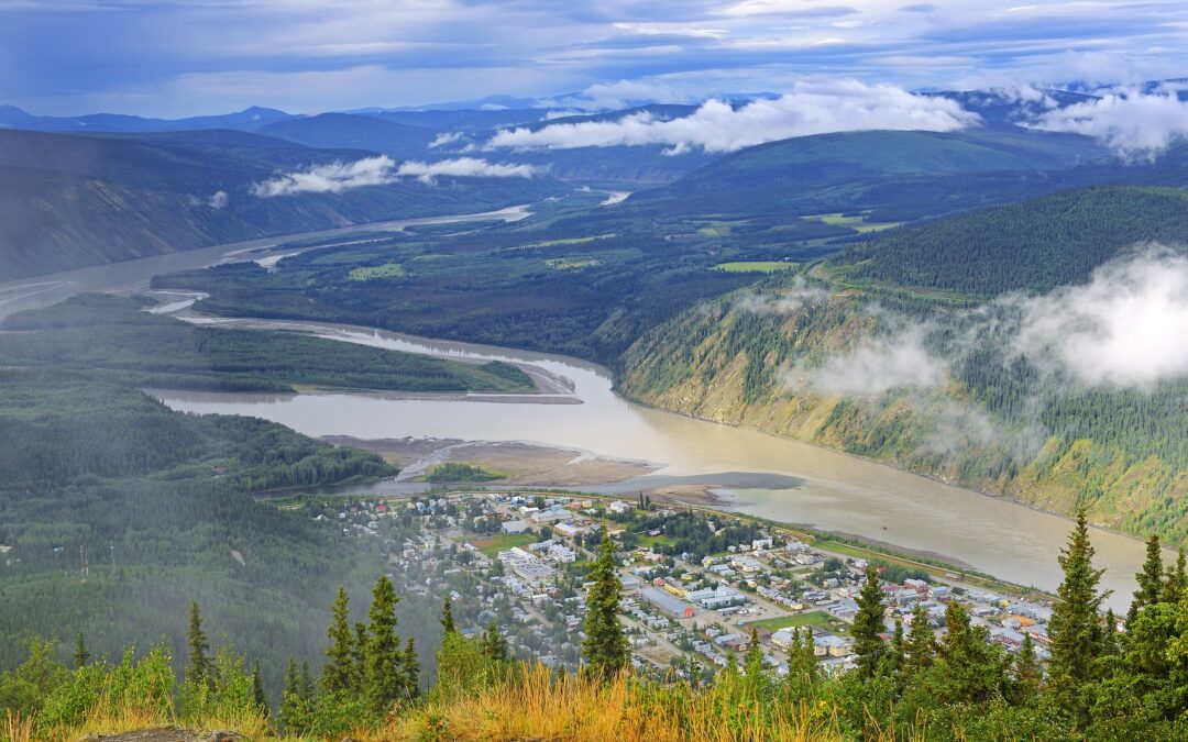
The Yukon exploration season is shorter than most project managers account for, and the margin for a poorly timed mobilization is close to zero. Between spring break-up, permafrost thaw cycles, and the onset of fall freeze, the usable field window for most ground geophysical programs sits at roughly 14 to 18 weeks—sometimes less at elevation. Getting a Yukon geophysical survey designed, permitted, and mobilized on the right schedule is not an administrative task. It drives the quality of the data.
Rangefront’s geophysical survey services extend across the full range of Canadian jurisdictions, including remote fly-in programs throughout the Tintina Gold Belt and Stikine Terrane. Our team’s work across geological mining services across Canada means we plan Yukon programs with the same field-level discipline that applies to any NI 43-101-quality program, from crew mobilization schedules to data deliverable timelines.
The Yukon Exploration Season: What the Calendar Actually Allows
Spring break-up in the Yukon typically occurs between late April and late May, depending on latitude and elevation. At lower elevations near the Alaska Highway corridor, access by ground vehicle may be possible by early May in a dry year. At higher elevations in the Pelly Mountains or along the Ogilvie Ranges, snow cover can persist into June. Most programs targeting these areas should not assume ground-based operations before June 1.
The productive window closes from the other end as well. Hard overnight frost becomes a routine issue by mid-September across much of the territory, and by early October, wet tundra begins to freeze at the surface while remaining saturated below. This creates handling problems for electrode-based methods and can affect equipment stability. Programs should target full crew demobilization by late September in most parts of the territory.
That leaves a realistic planning window of early June through mid-September for the majority of ground geophysical work. Fourteen weeks sounds sufficient. It rarely is, once you subtract travel days, weather delays, and the resupply cycles that fly-in programs require.
What Weather Actually Costs You
Budget one to two weather delay days per week for programs operating above 60°N. Afternoon convective storms are common across the Yukon interior in July and August, and they affect helicopter availability more than they affect ground crew productivity. A program relying on daily helicopter resupply or frequent repositioning should carry meaningful weather contingency in its schedule and budget. Building in zero contingency and hoping for a dry summer is not a logistics plan.
Access Planning: Roads, Helicopters, and Fixed-Wing Logistics
The Yukon’s road network is limited to a handful of major arteries: the Alaska Highway, the Klondike Highway, the Dempster Highway north to Inuvik, and a series of secondary resource roads with variable seasonal maintenance. Anything off those corridors typically requires either helicopter access or fixed-wing fly-in to a lake or gravel strip, followed by helicopter positioning.
Helicopter costs in the Yukon are substantial, and availability during peak exploration season (June through August) is competitive. Programs that mobilize in late June without securing aircraft early often find themselves competing with active mine operations and other exploration teams for the same local operators. Locking in a charter agreement before the field season begins is standard practice, not optional.
Fixed-wing access changes the logistics calculus for programs covering large block areas. A Super Cub or Cessna 206 on floats can service remote lake camps that would otherwise require multiple helicopter repositions per week. The tradeoff is that crew and equipment must be weight-optimized from the start, and survey designs need to account for where the aircraft can and cannot safely land.
Planning Mobilization Backward from Your Target Start Date
A useful exercise is to take your target first-production day in the field and work backward:
- Add travel days to the Yukon (typically one to two days from major hubs in Vancouver or Calgary).
- Add equipment shipping lead time if freight is moving by road rather than air. Add a day for local procurement and gear check in Whitehorse.
- Include permitting timelines if land tenure or land use permits under the Yukon Quartz Mining Act or Placer Mining Act are not yet in place.
Note that Yukon Energy, Mines and Resources (Mineral Resources Branch) does not publish fixed processing timelines — actual timelines vary by permit class, First Nations consultation requirements, and current application volumes. As of 2025–2026, the Branch has been managing a significant permit backlog and has introduced temporary regulatory measures to extend eligible approvals while renewals are processed; applicants should contact the Branch directly or monitor application status via the government’s PermitFlow dashboard for current estimates.
Most teams discover this exercise reveals that they needed to start planning eight to twelve weeks earlier than they did.
The Tintina Gold Belt is one of the most significant gold-bearing provinces in the northern North American Cordillera, stretching nearly 2,000 km across Alaska and the Yukon, with over 50 million ounces of lode gold resources defined to date. The targets it hosts span a range of deposit types, each with different geophysical responses and different optimal survey methods.
Orogenic gold systems hosted in Selwyn Basin stratigraphy often display subtle IP chargeability responses associated with arsenopyrite and pyrite in the alteration halo. Dipole-dipole or pole-dipole IP survey geometries resolve these targets well where topography permits reasonable electrode spacing and array deployment. For deeper targets, inversion modeling using platforms such as Res2DInv, the UBC-GIF suite, or SimPEG (among other industry tools) can extend effective depth of investigation, though the choice of software varies by practitioner and project, and no single platform is mandated by NI 43-101; resolution always degrades with depth regardless of the method.
Porphyry copper-gold targets, particularly those along the Stikine Terrane at its northernmost extent, respond well to IP as the primary pre-drill tool. Ground induced polarization surveys remain the standard approach for defining the sulfide footprint around a porphyry center before drill targeting.
When to Fly Before You Walk
Magnetic surveys run early in a program’s life cycle serve a different purpose than IP. They define structural architecture, map lithological contacts, and identify potential intrusive centers before a meter of grid has been cut. In terrain where grid cutting is expensive, running drone UAV magnetics first allows the team to prioritize where ground geophysics and eventually drilling makes the most sense. A drone mag program can cover several square kilometers per day in terrain that would take weeks to access on foot.
The sequence matters. Magnetics first gives you the structural picture. IP over the most compelling structural targets gives you the sulfide signature. Together, they support a drill decision that a geologist can defend in a NI 43-101 technical report.
NI 43-101 Compliance and Data Standards in Remote Programs
Any geophysical data set collected in support of a Canadian mineral resource estimate, or included in a technical report prepared under National Instrument 43-101, must meet the QC standards a qualified person can stand behind. In remote Yukon programs, that creates specific field discipline requirements that are easy to let slip when logistics are difficult.
GPS positioning of all survey stations must be recorded at the time of measurement, not reconstructed from base maps after the fact. Instrument calibration records need to be maintained throughout the program. Repeatability checks at fixed stations should be run at regular intervals to detect instrumental drift, particularly for IP surveys where electrode contact resistance can vary with ground conditions.
Data delivery format matters as much as the data itself. Clients integrating geophysical results with geological mapping in Oasis Montaj or similar platforms need survey data in compatible formats from the start. Reformatting data post-collection to fit a processing environment adds time and introduces transcription risk. Rangefront’s crews document chain-of-custody and GPS verification from the first day on the ground.
The Qualified Person Requirement
A NI 43-101 technical report that incorporates geophysical data requires a qualified person (QP) to take responsibility for that section of the report. Under NI 43-101, the QP must be a professional engineer or geoscientist who is in good standing with a ‘professional association’ as defined in the instrument—meaning a self-regulatory organization of engineers and/or geoscientists that meets specific statutory or CSA-recognized criteria—and must have at least five years of relevant experience in mineral exploration, mine development or operation, or mineral project assessment. Foreign associations must meet additional membership designation criteria set out in the Companion Policy.
Note: the CSA has proposed amendments to NI 43-101 (as of 2025) that would further revise the QP definition, and the current instrument text should be confirmed directly from the CSA. Rangefront’s technical services team works with project QPs to make sure the geophysical sections of technical reports are defensible, properly attributed, and internally consistent with the field data.
Working with Yukon First Nations on Exploration Program
The Yukon is unique in the Canadian jurisdictional landscape: under the Umbrella Final Agreement (UFA) and individual First Nations Final Agreements, eleven of the fourteen Yukon First Nations are self-governing, holding constitutionally protected rights over traditional territories that cover much of the territory, while the remaining three (White River First Nation, Liard First Nation, and Ross River Dena Council) remain under the Indian Act.
Exploration proponents operating in the Yukon are expected to engage with the relevant First Nation early in the planning process, before permit applications are submitted and well before field mobilization. The appropriate form and timing of that engagement depends on the specific First Nation, the nature and scale of the proposed program, and whether the area falls within settlement land or traditional territory. Leaving consultation to the last minute creates permit delays and project risk that no logistics plan can absorb.
Rangefront is not a legal or consultation services provider. What we can tell a project team is this: the programs that run on schedule are the ones where the operator engaged the relevant First Nation before the field season, not during it. Build consultation timelines into your planning horizon the same way you build in equipment lead times.
Yukon Geophysical Programs —
Frequently Asked Questions
Planning timelines, permafrost constraints, NI 43-101 data standards, logistical risks, and full-program execution — answered by Rangefront's field operations team.
Final Thoughts
If your Yukon exploration program is moving toward a summer field season, the time to finalize your geophysical program design is now, not after equipment is on a truck. Talk to Rangefront’s geophysical team about method selection, crew availability, and data deliverable timelines for your specific target and tenure. Request a project quote through the Vancouver office, or call (775) 753-6605 to reach the team directly.

ABOUT THE AUTHOR
BRIAN GOSS
President, Rangefront Mining Services
Brian Goss brings over 20 years of experience in gold and mineral exploration. He is the founder and President of Rangefront, a premier geological services and mining consulting company that caters to a large spectrum of clients in the mining and minerals exploration industries. Brian is also a director of Lithium Corp. (OTCQB: LTUM), an exploration stage company specializing in energy storage minerals and from 2014 to 2017, he fulfilled the role of President and Director of Graphite Corp. (OTCQB: GRPH), an exploration stage that specialized in the development of graphite properties. Prior to founding Rangefront, Brian worked as a staff geologist for Centerra Gold on the REN project, as well as various exploration and development projects in the Western United States and Michigan. Brian Goss holds a Bachelor of Science Degree with a major in Geology from Wayne State University in Michigan.
You may also be interested in...
5 Examples of Mineral Exploration
Mineral exploration is one of the first steps that takes place in a prospector’s journey from mineral discovery to active mining. This can be a long and resource-intensive process, but the payoffs can be significant. In mineral exploration, the goal is to investigate...
What Do Mining Consultants Do?
A successful mining project takes careful planning, expertise, and execution. With increasing focus on environmental regulations, corporate responsibility, political pressure, and more, engaging a mining consultant has become a practical solution to navigating the...

What to Look for in a Mining Recruiting Company
As the weather starts to warm, mining companies are beginning to recruit to fill seasonal contract needs. While some mining companies may use direct recruitment efforts, it’s more common for mining and exploration companies to use a recruiting service. WHAT TO LOOK...
Why Choose Rangefront for Your Mining Consulting Services
Rangefront provides a wide range of mining consulting services to help your project succeed. Whether you’re still in early exploration stages or looking to improve the output of your current project, the experts at Rangefront can help. WHY CHOOSE RANGEFRONT AS YOUR...
What are Mineral Reserves & Mineral Resources?
Mineral resources and mineral reserves are crucial data points in a mining company’s operations. In mining and exploration, the terms “Mineral Resource” and “Mineral Reserve” can be confusing—and are often used incorrectly or even interchangeably. Mineral resources...

Direct-Hire vs. Contract Labor: What are the Differences?
Rangefront offers both direct-hire and contract labor services, but what is the difference and how do you know which you need? THE DIFFERENCE BETWEEN CONTRACT LABOR AND DIRECT-HIRE IN MINING AND GEOLOGY When our clients tell us they need help with recruitment...
What to Know About Reference Materials in Mining Geology
If you are new to the metals industry; whether that be in exploration or production, you have probably come across or used a Certified Reference Material (CRM), also known as a “standard.” Standards are used in a wide variety of applications and for a variety of...

What is an NI 43-101 & What is it Used For?
An NI 43-101 report is a summary for potential investors of scientific and technical information for a mineral exploration, development, or production project. This report is required for listing on the Toronto Stock Exchange (TSX) and TSXV. Intended for the investing...

Steps in the Mining Consulting Process
For such an old industry, mining remains relatively enigmatic to new prospectors or early operations in today's economics. With complex geophysical and geochemical testing, ever-changing regulations and claims, reporting and processes, as well as the complications of...
FAQs About Mineral Exploration
As stated in our blog “8 Steps of Mineral Exploration,” mineral exploration is the process of seeking concentrated deposits of minerals for the purpose of mining these minerals for economic benefit. In this article, we discuss some of the frequently asked questions...
7 (More) Frequently Asked Questions About Claim Staking
Rangefront Mining Services has been in the mining industry for decades, which means we’ve seen more than our fair share of mining claims. In fact, each year we help our clients renew over 11,000 mining claims. Long story short, we have a lot of experience in claim...
The Role of Soil Sampling in Mineral Exploration
If you’re new to the mining or geology industries, you may have primarily heard of soil sampling for purposes related to engineering, construction, or even gardening. However, soil sampling is an important part of the mineral exploration and mining processes. WHAT IS...