A Comprehensive Guide — Updated July 20, 2026
After decades in this industry, one truth has never changed: the fastest way to lose a mining claim isn’t a geological dead end — it’s a paperwork failure. The regulatory landscape governing mining claims in the United States operates on two overlapping tracks: federal law, which establishes the foundational framework, and state law, which layers on additional requirements that vary considerably from jurisdiction to jurisdiction. A claim holder who only knows the federal side of the equation is flying half blind.
This article is current as of July 20, 2026. It covers the federal baseline, all 19 states where federal mining claims may be located on public lands, and relevant state-specific considerations.
Part I: The Federal Regulations
The General Mining Law of 1872 (as Amended)
General Mining Law of 1872 remains the governing statute for hardrock (locatable) mineral claims on federal public domain lands. It applies only to the 19 states where the Bureau of Land Management (BLM) administers public lands open to mineral entry. It does not apply to acquired lands, which require a prospecting permit under 43 CFR Part 3500.
Federal mining claims fall into three categories:
- Lode Claims cover hard rock mineral deposits in defined veins or ledges. Maximum size: 1,500 feet in length along the vein and 300 feet on each side, for a total of approximately 20 acres.
- Placer Claims cover minerals found in loose, unconsolidated materials such as stream gravels. Maximum size: 20 acres per individual locator, up to 160 acres for an association placer.
- Mill Sites and Tunnel Sites cover non-mineral land used for mining or processing purposes (mill sites) or subsurface tunnel exploration (tunnel rights).
2026 Federal Fee Schedule
The BLM fee structure effective for the 2026 assessment year is as follows. The maintenance fee was increased to $200 per claim on July 1, 2024, and remains at that level.
New Claims (located on or after September 1, 2024):
- Location Processing Fee: $25
- Location Fee: $49
- Maintenance Fee (initial): $200 per lode claim, mill site, or tunnel site; $200 per 20 acres (or portion thereof) for placer claims
- Total per lode/mill/tunnel claim: $274
Existing Claims — Annual Maintenance Fee:
- $200 per lode claim, mill site, or tunnel site
- $200 per 20 acres (or portion thereof) for placer claims
2026 Annual Deadline: September 2, 2026 The standard September 1 deadline falls on a federal holiday (Labor Day) this year, so all annual maintenance fee payments and small miner’s waiver filings are extended to September 2, 2026.
Small Miner’s Waiver (Maintenance Fee Waiver)
Claimants who own 10 or fewer claims and sites nationwide (counting all related parties) may qualify to waive the annual maintenance fee in lieu of performing assessment work.
To qualify, you must:
- File Form 3830-2 (Maintenance Fee Waiver Certification) with the BLM State Office by September 2, 2026. There is no charge for filing the waiver itself.
- File an Affidavit of Assessment Work (Form 3830-4) by December 30, 2026, with a $15 processing fee per claim, demonstrating at least $100 worth of labor or improvements performed on each claim.
- If it is the first year you are filing a waiver, you must also file a Notice of Intent to Hold by December 30, 2026 ($15 per claim). This form is also required the first year a new claim is located when a waiver is filed.
Note: Faxed or emailed waivers are not accepted. Original signatures are required. If an agent signs on the claimant’s behalf, a current notarized Power of Attorney must accompany the filing.
Recording a New Claim
Under Section 314 of the Federal Land Policy and Management Act (FLPMA), new claims must be recorded with both the appropriate BLM State Office and the relevant County Recorder’s Office within 90 days of the date of location. The BLM now processes new claim filings through the Mineral & Land Records System (MLRS) at mlrs.blm.gov, which has replaced the older LR2000 system and allows online payment for most states (Alaska requires direct paper filing with the BLM Alaska State Office).
Critical note: Many states have shorter county recording deadlines that are more restrictive than the 90-day federal rule. State law controls the county recording deadline; failure to meet it can invalidate the claim even if the BLM filing is timely. See the state-by-state section below.
The One Big Beautiful Bill Act (OBBBA) — Enacted July 4, 2025
Claim holders should be aware that President Trump signed the One Big Beautiful Bill Act into law on July 4, 2025. For hardrock mining claims under the 1872 Mining Law, the OBBBA did not directly alter the existing unpatented mining claim structure, maintenance fees, or location requirements. However, the law made significant changes in adjacent areas that affect the mining industry:
- Federal coal royalty rates were temporarily reduced from 12.5% to a maximum of 7% (effective through September 30, 2034), which applies to coal leases — not 1872 Act hardrock claims.
- Onshore oil and gas royalties returned to a 12.5% minimum, reversing Inflation Reduction Act increases.
- Critical mineral incentives tied to the IRA were partially phased out, affecting tax credit structures for lithium, cobalt, and rare earth projects.
- Federal land access was expanded, and NEPA review timelines were addressed for certain energy and mineral leasing actions.
The Mining Regulatory Clarity Act, which would clarify how “ancillary” operations (waste rock, tailings) may use federal land adjacent to valid mining claims, remains pending in Congress as of this writing and has not been enacted.
Part II: The 19 States — Requirements and Resources
Federal mining claims may be located on public domain lands in 19 states. The following covers the state-specific filing requirements, county recording deadlines, and any notable state-level regulatory obligations for each. This information is correct as of July 20, 2026. Always verify current requirements directly with your BLM State Office and county recorder before filing, as regulations are subject to change.
Alaska
Overview: Alaska is unique in that it has a parallel state mining claim system administered by the Alaska Division of Mining, Land and Water (DNR) that operates independently of the federal BLM system. State-owned lands (approximately 92% of conveyed state acreage) are open to mineral entry under Alaska Statute Title 38. Federal BLM claims operate on federal public lands in Alaska.
State Claims (on State-owned land):
- A discovery of locatable minerals is required before staking a valid state mining claim.
- Claims must be staked with four corner posts aligned in cardinal directions (N/S/E/W).
- Maximum claim size: 1,320 feet in the longest dimension.
- A Certificate of Location must be recorded at the District Recorder’s Office within 45 days of staking.
- Annual rental on state claims runs September 1 to August 31. Payment is due by November 30 of the same year. Failure to pay results in automatic abandonment.
- Annual labor (assessment work) is required each year; failure to timely record a statement of annual labor can affect claim validity.
Federal Claims (BLM, Alaska):
- BLM Alaska payments cannot be made online; claimants must pay and file directly with the BLM Alaska State Office in Anchorage.
- The BLM’s MLRS online payment portal does not cover Alaska claims.
State Agency: Alaska DNR Division of Mining, Land and Water — the Division has updated Alaska Mapper to generate recordable claim sketch maps meeting 11 AAC 86.215 requirements.
Resources:
- Alaska DNR Mining: https://dnr.alaska.gov/mlw/mining/
- Alaska Mineral Property Management: https://dnr.alaska.gov/mlw/mining/mpm/
- BLM Alaska Mining: https://www.blm.gov/programs/energy-and-minerals/mining-and-minerals/about/alaska
Arizona
Overview: Arizona has one of the largest active mining claim inventories in the western United States. State law (Arizona Revised Statutes, Title 27) governs the location and recording of claims.
State-specific requirements:
- Notice of Location must be filed with the county recorder within 30 days of staking.
- Corner posts must extend four feet above the ground (ARS 27-204) — posts are typically 60 inches total length if set 12 inches in the ground.
- Claims must also be filed with the BLM Arizona State Office within 90 days of location.
- Annual assessment work must be performed, and an Affidavit of Assessment Work must be filed with both the county recorder and BLM Arizona by December 30.
Resources:
- BLM Arizona Mining and Minerals: https://www.blm.gov/programs/energy-and-minerals/mining-and-minerals/about/arizona
- Arizona State Mine Inspector: https://asmi.az.gov/
- Arizona Geological Survey: https://azgs.arizona.edu/
Arkansas
Overview: Arkansas has one of the smallest inventories of active federal mining claims of any state where claims can be located — as of mid-2026, only approximately 13 active federal claims are on record, split between a handful of lode and placer filings.
State-specific requirements:
Arkansas has no state-level county recording requirement for mining claims. Under 43 CFR §3833.11, claimants must still record a document with BLM and the local recording office containing all required information. This is explicitly acknowledged in the federal regulations as an Arkansas-specific exception.
Acquired vs. Public Domain Land
Surface lands within the jurisdiction of the BLM Eastern States are primarily acquired lands managed by other agencies. Mining claims for locatable minerals may not be staked on most of these lands, but there are scattered areas in Arkansas, Louisiana, Mississippi, and Florida where mining claims may be staked for hard rock minerals. Public domain lands within BLM Eastern States are not open to the location of mining claims. The claimant must verify that the specific parcel is public domain land before staking.
One exception is the Ouachita National Forest, where quartz mining authorization is managed by contracts, not standard BLM claims. Prospectors and commercial operators interested in quartz on National Forest land must work directly with the Ouachita National Forest, not the BLM.
Resources:
- BLM Eastern States Office (minerals and mining): https://www.blm.gov/programs/energy-and-minerals/mining-and-minerals/about/eastern-states
- Arkansas DEQ Mining Program: https://www.adeq.state.ar.us/mining/
- Arkansas DEQ Non-Coal Mining (Rule 15): https://www.adeq.state.ar.us/mining/noncoal.aspx
- Ouachita National Forest (quartz contracts and collecting): https://www.fs.usda.gov/ouachita
- 43 CFR §3833.11 (no-county-recording-requirement exception): https://www.ecfr.gov/current/title-43/subtitle-B/chapter-II/subchapter-C/part-3833/subpart-A/section-3833.11
California
Overview: California is one of the most heavily regulated states for mining in the country, with the Surface Mining and Reclamation Act of 1975 (SMARA) creating a comprehensive second layer of requirements on top of federal law.
State-specific requirements (federal claims):
- Notice of Location must be filed with the county recorder within 90 days of staking (California Public Resources Code §2301).
- SMARA — Critical State Overlay: For any surface mining operation that disturbs more than one acre of surface or moves more than 1,000 cubic yards, SMARA imposes the following:
- A Surface Mining Permit (or vested right determination) must be obtained from the local lead agency (city or county).
- An approved Reclamation Plan is required before commencing operations.
- Financial Assurances (bonds or equivalent) must be posted to cover the estimated cost of final reclamation.
- Annual Reporting is required under Public Resources Code §2207.
- Annual Inspection by the lead agency is required.
SMARA is administered at the local level by each city and county as the “lead agency,” with state oversight by the California Department of Conservation, Office of Mine Reclamation (OMR). The State Mining and Geology Board last amended its mining ordinance guidance in December 2024.
Resources:
- BLM California Mining: https://www.blm.gov/programs/energy-and-minerals/mining-and-minerals/about/california
- California Office of Mine Reclamation (SMARA): https://www.conservation.ca.gov/dmr/lawsandregulations
- California Mining Location Statutes: Public Resources Code § 3902 (2025)
Colorado
Overview: Colorado has an active hardrock mining industry with significant historical production in gold, silver, molybdenum, and base metals.
State-specific requirements:
- Notice of Location must be filed with the county recorder and BLM Colorado State Office within 90 days of staking.
- Colorado has no separate state mining claim statute that differs substantially from federal requirements for location and maintenance.
- Operations on state lands require permits from the Colorado Division of Reclamation, Mining and Safety (DRMS).
Resources:
- BLM Colorado Mining: https://www.blm.gov/programs/energy-and-minerals/mining-and-minerals/about/colorado
- Colorado DRMS: https://cdphe.colorado.gov/division-of-reclamation-mining-and-safety
- BLM Colorado Mining Packet: https://www.blm.gov/office/colorado-state-office
Florida
Overview: Florida produces more than 60% of U.S. phosphate and accounts for roughly 25% of global supply, and its heavy mineral sands deposits (titanium minerals, zircon, staurolite) rank among the most economically significant in the country. However, Florida’s federal mineral activity operates almost entirely outside the 1872 Mining Law framework, and the state’s private and regulatory structures are the dominant force for anyone doing business here.
Acquired Land
Like Arkansas, Louisiana, and Mississippi, Florida is in the BLM Eastern States jurisdiction, where surface lands are primarily acquired lands managed by other agencies. Mining claims for locatable minerals may not be staked on most of these lands, but there are scattered areas in Florida where mining claims may be staked for hard rock minerals. Public domain lands within BLM Eastern States are not open to the location of mining claims.
This means the overwhelming majority of federal land in Florida, including National Forests, National Wildlife Refuges, and other federally managed areas, consists of acquired lands. Locatable hardrock mining claims under the 1872 Mining Law cannot be staked on acquired land. The small inventory of public domain parcels where claims theoretically could be filed is extremely limited and not the basis for any significant active mineral production in the state.
Additional state requirements include:
- A Conceptual Reclamation Plan or Notice of Intent to Mine must be filed before commencing operations, depending on the mineral type.
- Reclamation standards vary by mineral and are codified separately for phosphate, limestone/shell/dolomite, heavy minerals (defined as minerals with a specific gravity not less than 2.8, including zircon, staurolite, ilmenite, leucoxene, and rutile), fuller’s earth, peat, and sand and gravel.
- A Wetland Resource Permit (WRP) may also be required for any project involving dredging or filling in or near wetlands, which is nearly universal in Florida mining operations given the state’s hydrology.
- Local county governments and water management districts may impose additional permitting requirements.
Active Rulemaking — June 2026
Florida’s DEP Mining and Mitigation Program is actively revising several of its core mining rules as of mid-2026, including draft amendments to 62C-36, 62C-37, 62C-16, 62C-17, and 62C-39, Florida Administrative Code. Anyone engaged in Florida mining permitting should verify they are working from the current rule text, as changes may affect reclamation standards, financial assurance requirements, and ERP procedures.
Resources:
- BLM Eastern States Office (Florida mineral leasing): https://www.blm.gov/programs/energy-and-minerals/mining-and-minerals/about/eastern-states
- Florida DEP Mining and Mitigation Program: https://floridadep.gov/water/mining-mitigation
- Florida DEP Mining FAQs (ERP process, reclamation requirements): https://floridadep.gov/water/mining-mitigation/content/mining-faqs
Idaho
Overview: Idaho is a productive state for gold, silver, and base metal prospecting, particularly in the central and northern regions.
State-specific requirements:
- Notice of Location must be filed with the county recorder within 90 days of the date of staking — Idaho Code §47-602.
- Corner monuments must be least four feet high and four inches square or in diameter. Each post and monument must be marked with the name of the claim, the position or number of the corner or angle and the direction of the boundary lines. Where it is impracticable to place a monument or post in its true position, a witness monument should be erected and marked to indicate the true position of the corner or angle.
- Idaho Department of Lands (IDL) governs state-owned minerals on state lands separately from BLM.
Resources:
- BLM Idaho Mining: https://www.blm.gov/programs/energy-and-minerals/mining-and-minerals/about/idaho
- Idaho Department of Lands Minerals: https://www.idl.idaho.gov/minerals/
- Idaho Mining Association: https://www.idahomining.org/
Louisiana
Overview: Louisiana shares the same fundamental acquired-land constraint as Arkansas, Florida, and Mississippi — most federal land in the state consists of acquired rather than public domain land, limiting where 1872 Mining Law claims can actually be staked. That said, there are scattered areas in Louisiana where mining claims may be staked for hard rock minerals.The BLM Eastern States Office in Springfield, Virginia is the filing office for any federal claims in Louisiana.
Federal Claim Filing
Where public domain land open to mineral entry does exist in Louisiana, all standard federal BLM requirements apply:
- File with the county clerk’s office and BLM Eastern States within 90 days of location
- Pay applicable fees ($274 per lode claim for new filings), and maintain annually by September 1
- There is no Louisiana-specific state mining claim statute that creates additional location or recording requirements layered on top of the federal framework.
Kisatchie National Forest
The only National Forest in Louisiana, Kisatchie National Forest encompasses roughly 604,000 acres across seven parishes in central and northern Louisiana. As acquired land, hardrock mining claims generally cannot be staked within it. However, the BLM retains subsurface mineral jurisdiction, and any federal mineral interest in National Forest System lands is managed through the BLM Eastern States Office under the Mineral Leasing Act for Acquired Lands.
Resources:
- BLM Eastern States Office: https://www.blm.gov/programs/energy-and-minerals/mining-and-minerals/about/eastern-states
- Louisiana Department of Conservation and Energy (formerly DENR): https://www.dce.louisiana.gov/
- Louisiana DEQ: https://www.deq.louisiana.gov/
Mississippi
Overview: Mississippi is the least active of the four eastern-states BLM jurisdictions for hardrock federal mining claims, but it does appear on the list of states where claims can theoretically be located on scattered public domain parcels. As with Arkansas, Louisiana, and Florida, mining claims for locatable minerals may not be staked on most federal lands in Mississippi, but there are scattered areas where mining claims may be staked for hard rock minerals.
Federal Claim Filing
Where public domain land open to mineral entry exists in Mississippi, standard BLM procedures apply through the BLM Eastern States Office:
- County recording within 90 days of location is required.
- Mississippi has no separate state mining claim statute creating additional location or recording requirements beyond the federal framework.
Resources:
- BLM Eastern States Office: https://www.blm.gov/programs/energy-and-minerals/mining-and-minerals/about/eastern-states
- MDEQ Mining and Reclamation Division: https://geology.deq.ms.gov/mining/
- Mississippi Surface Mining and Reclamation Act: https://www.sos.ms.gov/ACProposed/00016552b.pdf
Montana
Overview: Montana is a significant hardrock mining state with active production of gold, silver, copper, platinum group metals, and coal. The Montana Department of Environmental Quality (DEQ) oversees state-level mine permitting.
State-specific requirements:
- Notice of Location must be filed with the county clerk and recorder within 90 days of staking — Montana Code Annotated (MCA) §82-2-302.
- Post a written or printed notice of location containing the name of the claim, the name of the locator, the date of the location, which must be the date of posting the notice, and the approximate dimensions of the area of the claim intended to be appropriated.
- Within 30 days after posting the notice of location, the person must mark the location with a monument at each corner or angle of the claim, consisting of any one of the following kinds:
-
-
- A tree at least 8 inches in diameter and blazed on four sides;
- A post at least 4 inches square by 4 feet 6 inches in length, set 1 foot in the ground, unless solid rock should occur at a less depth, in which case the post should be set upon the rock and surrounded in all cases by a mound of earth or stone at least 4 feet in diameter by 2 feet in height. A squared stump of the requisite size, surrounded by a mound, must be considered the equivalent of a post and mound.
- A stone at least 6 inches square by 18 inches in length, set two-thirds of its length in the ground, with a mound of earth or stone alongside at least 4 feet in diameter by 2 feet in height
- A boulder at least 3 feet above the natural surface of the ground on the upper side. Whatever monument is used, it must be marked with the name of the claim and the designation of the corner, either by number or cardinal point.
-
Within 60 days after posting notice, the locator shall comply with the United States mining laws.
-
-
Resources:
- BLM Montana/Dakotas Mining: https://www.blm.gov/programs/energy-and-minerals/mining-and-minerals/about/montana
- Montana DEQ Mine Permitting: https://deq.mt.gov/Mining
- Montana Code Annotated, Mining Laws: https://leg.mt.gov/bills/mca/title_0820/chapter_0020/parts_index.html
Nebraska
Overview: Nebraska is administered by the BLM Wyoming State Office rather than BLM Eastern States, placing it in a different administrative context than Arkansas, Louisiana, Mississippi, and Florida. The state has genuine historical hardrock mining claim activity, concentrated almost entirely in the northwestern Panhandle counties — specifically Dawes and Sioux counties — where the Pine Ridge escarpment and adjacent areas of the Nebraska National Forest overlie portions of the same Black Hills geologic province that hosts significant gold and uranium mineralization in South Dakota and Wyoming.
Where Claims Actually Exist
Nebraska has 788 records of mining claims on public land managed by the Bureau of Land Management,.The vast majority of these are closed historical claims, with only a handful currently active. Active claims are concentrated in the Crawford, Whitney, and Marsland areas of Dawes County, within or adjacent to the Nebraska National Forest (Pine Ridge Ranger District). The Soldier Creek Wilderness within the Pine Ridge unit is withdrawn from mineral entry, as are all federally designated wilderness areas.
Uranium: The Crow Butte/Cameco Story
Nebraska’s most significant modern mineral extraction has been uranium, via in-situ leach (ISL) mining in Dawes County. The Crow Butte uranium deposit near Marsland and Crawford was operated by Crow Butte Resources (a subsidiary of Canadian company Cameco Corp.) for decades.
State-Level Permitting
Nebraska has a specific permitting requirement that may apply before drilling exploration holes:
- the Mineral Exploration program of the Nebraska Department of Environment and Energy (DWEE) issues and reviews permits for holes drilled, driven, bored, or dug for the purpose of mineral exploration, regulated under Title 135 — Rules and Regulations for Mineral Exploration Holes. This applies to persons exploring for consolidated rock, sand and gravel, or other materials beneath the surface or in state waters.
- Federal mining claims in Nebraska are filed with the BLM Wyoming State Office in Cheyenne, which administers Nebraska claims. County recording is also required, within 90 days of location. The BLM is actively proposing new Resource Management Plans for northeast Wyoming and Nebraska as of July 2026, which may affect land use designations and mineral entry status in some areas.
Resources:
- BLM Wyoming State Office (administers Nebraska): https://www.blm.gov/office/wyoming-state-office
- Nebraska National Forest (Pine Ridge Ranger District): https://www.fs.usda.gov/nebraska
- Nebraska DWEE Mineral Exploration Program: https://dwee.nebraska.gov/groundwater-drinking-water/groundwater/mineral-exploration-program
Nevada
Overview: Nevada is the most active mining claim state in the country, with more active claims than any other state. Nevada Revised Statutes (NRS) Chapter 517 governs mining claims, and the Nevada Division of Minerals maintains comprehensive oversight.
State-specific requirements:
- Certificate of Location must be recorded with the county recorder within 90 days of posting the location notice.
- NRS 517 requires that a map of the claim be filed simultaneously with the Certificate of Location with the county recorder. The Nevada Division of Minerals maintains specific map specifications.
- Corner posts: Nevada requires a 4-inch square post (2″×2″ cross-section), 4 feet long, set 1 foot in the ground. Plastic open-ended PVC posts are prohibited under Nevada law; the county recorder must require their replacement.
- Lode claim monument posts must extend above the surface with the Notice of Location posted on or near the discovery monument.
- Affidavit of Work or Notice of Intent to Hold must be filed with the county recorder by January 15 of the year following the assessment year (county requirement; BLM deadline remains December 30).
- The Nevada Division of Minerals (NDOM) maintains an interactive mining claims map and filing information.
Resources:
- Nevada Division of Minerals (Mining Claims): https://minerals.nv.gov/Programs/Mining/MiningClaims/
- Nevada Revised Statutes Chapter 517: https://www.leg.state.nv.us/nrs/nrs-517.html
- BLM Nevada Mining: https://www.blm.gov/programs/energy-and-minerals/mining-and-minerals/about/nevada
- BLM Nevada State Office: 1340 Financial Blvd, Reno, NV 89502 | 775-861-6400
New Mexico
Overview: New Mexico is one of the most mineral-rich states in the country, with a diverse production profile including copper, potash, coal, uranium, gold and silver, and molybdenum. The state has one of the more rigorous state-level hardrock mining regulatory frameworks in the West.
Federal Claim Filing
- Notice of Location must be filed with the county clerk within 90 days of the date of location — New Mexico Statutes §69-3-1. This is consistent with the federal 90-day window, so there is no shorter state-imposed deadline to track separately.
- Claims are filed with the BLM New Mexico State Office in Santa Fe, which also administers federal mineral interests in Kansas, Oklahoma, and Texas.
- Land status verification is strongly recommended before staking, as significant portions of New Mexico’s public lands carry complex withdrawal histories related to national monuments, wilderness areas, and military reservations.
State Lands
New Mexico State Trust Lands, administered by the New Mexico State Land Office, require separate mineral leases for any extraction activity. The State Land Office’s minerals program covers potash, sodium chloride, caliche, gypsum, clay, sand, gravel, and stone leasing, each under specific leasing rules. Federal BLM claims cannot be staked on state trust lands.
Resources:
- BLM New Mexico State Office: https://www.blm.gov/programs/energy-and-minerals/mining-and-minerals/about/new-mexico
- NM EMNRD Mining and Minerals Division: https://www.emnrd.nm.gov/mmd/
- New Mexico Mining Act Reclamation Program: https://www.emnrd.nm.gov/mmd/mining-act-reclamation-program/
- MMD Mine Registration and Reporting: https://www.emnrd.nm.gov/mmd/mine-registration-and-reporting-program/
- New Mexico State Land Office Minerals: https://www.nmstatelands.org/divisions/oil-gas-and-minerals/minerals/
North Dakota
Overview: North Dakota’s dominant mineral activity — oil, gas, and lignite coal — operates almost entirely outside the 1872 Mining Law framework. For hardrock mining claim purposes, the state has a very limited profile.
Hardrock Mining Claims: Little Missouri Grassland
The primary land base where 1872 Act hardrock mining claims can potentially be located in North Dakota is within the Little Missouri National Grassland. At over one million acres, it is the largest National Grassland in the United States, administered by the USDA Forest Service but with BLM retaining subsurface mineral jurisdiction. In practice, active hardrock claim activity in North Dakota is extremely limited, with historical records showing only a handful of mine sites in the state, primarily iron, lignite, manganese, and uranium occurrences in the western Badlands region.
BLM Filing and Administration
- Federal mining claims in North Dakota are filed with the BLM Montana State Office in Billings, which administers claims in Montana, North Dakota, and South Dakota.
- County recording within 90 days of location is required.
Resources:
- BLM Montana/Dakotas State Office (administers North Dakota): https://www.blm.gov/office/montana-dakotas-state-office
- North Dakota Department of Mineral Resources: https://www.dmr.nd.gov/
- North Dakota DMR Subsurface Regulations: https://www.dmr.nd.gov/dmr/ndgs/subsurface-regulations
- Little Missouri National Grassland: https://www.fs.usda.gov/dakota-prairie
- 2025 ND RMP (approved January 2025): https://www.blm.gov/programs/planning-and-nepa/plans-in-focus/montana/north-dakota-rmp
Oregon
Overview: Oregon has active gold mining history in the southwestern and eastern regions. The Oregon Department of Geology and Mineral Industries (DOGAMI) provides state oversight.
State-specific requirements:
- Notice of Location must be filed with the county clerk within 60 days of the date of location — Oregon Revised Statutes (ORS) §517.080.
- Oregon also requires that the county recording cover page meet specific county requirements; recording fees and formats vary by county (Jackson County, for example, has a published fee schedule).
- Operations exceeding casual use on state or private lands may require permits from DOGAMI.
- The Oregon Department of State Lands (DSL) regulates mining in state waters and on state-owned lands.
Resources:
- BLM Oregon/Washington Mining: https://www.blm.gov/programs/energy-and-minerals/mining-and-minerals/about/oregon
- DOGAMI: https://www.oregongeology.org/
- BLM Oregon/Washington State Office: 333 SW 1st Avenue, Portland, OR 97204 | 503-808-6001
South Dakota
Overview: South Dakota’s mining identity is defined almost entirely by the Black Hills, one of the most historically productive gold districts in North American history. The state has an actively enforced state permitting framework on top of the federal BLM system.
Federal Claim Filing
- Notice of Location must be filed with the county register of deeds within 90 days of the date of location, consistent with the federal BLM deadline.
- Anyone filing a mining claim in South Dakota must comply with South Dakota Codified Laws (SDCL) Chapter 45-4, which governs the location and recording of mining claims on federal lands within the state.
- Claims are filed with the BLM Montana/Dakotas State Office in Billings (phone: 406-896-5004), which administers South Dakota’s federal mineral interests.
Exploration Permitting
Under SDCL 45-6C, exploration under a Notice of Intent requires reclamation surety to be posted before exploration commences. Motorized equipment including suction dredges require permits from DANR and potentially from the U.S. Army Corps of Engineers for Section 404 purposes.
Resources:
- BLM Montana/Dakotas State Office (administers South Dakota): https://www.blm.gov/office/montana-dakotas-state-office | 406-896-5004
- South Dakota DANR Minerals, Mining, and Superfund: https://danr.sd.gov/Environment/MineralsMining/
- South Dakota Mine Permit Forms: https://danr.sd.gov/Environment/MineralsMining/Exploration/MinePermits.aspx
- Black Hills National Forest (gold panning and prospecting): https://www.fs.usda.gov/r02/blackhills/recreation/gold-panning-rockhounding-metal-detecting
Utah
Overview: Utah is one of the most active mining claim states in the western U.S. and is home to a remarkable diversity of mineral production: copper, gold, silver, uranium and vanadium, potash, coal, beryllium, and industrial minerals including gilsonite, phosphate, and potassium.
The 30-Day County Recording Deadline
- Notice of Location must be filed with the county recorder within 30 days of the date of staking — Utah Code §40-1-3. This is one of the shortest deadlines of any western state, less than a third of the 90-day federal BLM window. Missing the county deadline can invalidate a claim entirely, even if the BLM filing is timely. New claim holders should treat this as the operative deadline and plan accordingly.
Monument Requirements
The state of Utah currently has no specified requirements for location or corner markers used in staking a claim; following the California requirements for claim markers is suggested by UDOGM. As a practical matter, markers must be “conspicuous and substantial” under federal regulation (43 CFR §3832), and many claimants use 4-foot posts consistent with BLM general guidance.
Resources:
- BLM Utah Mining: https://www.blm.gov/programs/energy-and-minerals/mining-and-minerals/about/utah
- Utah UDOGM Minerals General FAQs: https://ogm.utah.gov/minerals-gerneral-faqs/
- Utah UDOGM Minerals Permit Forms: https://ogm.utah.gov/minerals-permitting/
- BLM Utah State Office: 440 West 200 South, Suite 500, Salt Lake City, UT 84101 | 801-539-4001
Washington
Overview: Federal mining claims may be located on public domain lands in Washington, primarily in the Okanogan Highlands, Colville National Forest area, and parts of eastern Washington.
State-specific requirements:
- Notice of Location must be filed with the county auditor within 90 days of the date of location.
- Washington has specific county recording cover page requirements that vary by county; verify format requirements before filing.
- The Washington Department of Natural Resources (DNR) regulates mining on state lands and issues permits for certain surface mining operations.
Resources:
- BLM Oregon/Washington (administers Washington): https://www.blm.gov/programs/energy-and-minerals/mining-and-minerals/about/oregon
- Washington DNR Geology and Earth Resources: https://www.dnr.wa.gov/geology
- BLM Oregon/Washington State Office: 333 SW 1st Avenue, Portland, OR 97204 | 503-808-6001
19. Wyoming
Overview: Wyoming statutes interlock heavily with federal regulations, including the General Mining Law of 1872, governing the extraction of locatable minerals on public lands
Federal Claim Filing
- Notice of Location must be filed with the county clerk within 90 days of the date of location, consistent with the federal BLM deadline.
- The certificate must include the claim name, locator names, date of location, length/course of the vein, amount of surface ground claimed, and a definitive description mapping natural or fixed landmarks.
- Lode claim widths cannot exceed 300 feet on each side of the discovery shaft. The statute also explicitly states that these provisions do not apply to coal mines.
- Claims are filed with the BLM Wyoming State Office in Cheyenne, which also administers federal mineral interests in Nebraska.
A BLM Wyoming Mining Claim Packet is available from the Wyoming State Office and covers all applicable procedures, forms, and contact information.
Resources:
- BLM Wyoming Mining: https://www.blm.gov/programs/energy-and-minerals/mining-and-minerals/about/wyoming
- WDEQ LQD Exploration and Prospecting: https://deq.wyoming.gov/land-quality/exploration-and-prospecting/
- BLM Wyoming State Office: 5353 Yellowstone Road, Cheyenne, WY 82003 | 307-775-6256
Part III: Key Regulatory Deadlines Summary (2026)
| Deadline | Requirement |
|---|---|
| September 2, 2026 | Annual maintenance fee payment OR small miner’s waiver — all existing claims |
| Within 30 days of staking | County recording required in: Arizona, Utah |
| Within 45 days of staking | State recording required in: Alaska (state claims) |
| Within 60 days of staking | County recording required in: Oregon |
| Within 90 days of staking | BLM filing required in all states; county recording in: California, Colorado, Idaho, Montana, Nevada, New Mexico, South Dakota, Washington, Wyoming, et al. |
| December 30, 2026 | Affidavit of Assessment Work and/or Notice of Intent to Hold (for small miner’s waiver filers) |
Part IV: Cross-Cutting Regulatory Considerations
Environmental Compliance
Environmental compliance is increasingly a condition for maintaining an active mining operation, and this trend has accelerated. Three federal programs interact with mining claims regardless of state:
NEPA (National Environmental Policy Act): Any federal nexus to a mining project (BLM-administered land, federal permitting, federal financing) triggers NEPA review. The level of review — categorical exclusion, environmental assessment, or full EIS — depends on the scale of impact.
Clean Water Act Section 404: Operations in or near waters of the United States, including wetlands, require Corps of Engineers permits for dredge-and-fill activities. Discharge of process water or mine drainage requires NPDES permits from EPA or the delegated state agency.
National Historic Preservation Act (NHPA) Section 106: Federal consultation is required before disturbing areas that may contain cultural resources, including tribal sacred sites and archaeological deposits. This is a significant concern in many western states.
Tribal Consultation
The interaction between mining claims and tribal interests has grown considerably more complex in recent years. Tribal consultation requirements under NHPA Section 106 apply wherever there is a federal nexus, and some tribes have pursued legal challenges to specific mine projects on the basis of treaty rights, cultural resource protection, and environmental concerns. Claim holders planning operations in areas with historic tribal connections should engage proactively with tribal governments at the earliest possible stage.
Operations Permits: Notice vs. Plan of Operations
Holding an unpatented mining claim grants mineral rights , but it does not automatically authorize surface disturbance. The BLM distinguishes between:
- Casual Use: Activities causing only negligible disturbance (hand tools, small-scale panning) generally no BLM notification required.
- Notice-Level Operations: Planned surface disturbance of less than 5 acres requires filing a Notice of Intent with BLM; typically processed within 15 days.
- Plan of Operations: Disturbance of 5 acres or more, or operations involving mechanized equipment, explosives, or chemical processing requires an approved Plan of Operations from BLM before commencing; subject to full environmental review.
These thresholds are federal minimums. Many state agencies impose more stringent thresholds, as California’s SMARA illustrates (1 acre/1,000 cubic yards).
Part V: Key Federal and Universal Resources
- BLM Mining Claims Program: https://www.blm.gov/programs/energy-and-minerals/mining-and-minerals/locatable-minerals/mining-claims
- Mineral & Land Records System (MLRS) — New Claims, Payments, Research: https://mlrs.blm.gov/
- BLM 2026 Mining Season Packet (PDF): https://www.blm.gov/sites/default/files/docs/2025-07/2026_Mining_Season_508.pdf
- BLM Recording Requirements: https://www.blm.gov/programs/energy-and-minerals/mining-and-minerals/locatable-minerals/mining-claims/recording
- BLM Locating a Claim: https://www.blm.gov/programs/energy-and-minerals/mining-and-minerals/locatable-minerals/mining-claims/locating-a-claim
- eCFR Title 43 Part 3833 (Recording Mining Claims): https://www.ecfr.gov/current/title-43/subtitle-B/chapter-II/subchapter-C/part-3833
Final Thoughts
After forty years watching claim holders lose rights they’d worked hard to establish, the patterns are consistent: missed county recording deadlines (especially in Utah and Arizona, where the 30-day window is brutally short), unpaid maintenance fees, and operations that outgrew the “casual use” threshold without triggering the required BLM notification. The regulatory system rewards the disciplined and forfeits to the careless.
The current federal environment is favorable to mining — the OBBBA accelerated leasing timelines, critical mineral projects have renewed political support, and BLM has modernized its MLRS system to make digital filings more accessible. But state-level requirements remain what they’ve always been: granular, county-by-county, and unforgiving of errors.
When in doubt, call your BLM State Office. They are generally helpful, they have the most current information, and that phone call costs nothing compared to the forfeiture of a claim you’ve spent years developing.
This article reflects publicly available regulatory information as of July 20, 2026. Mining laws and regulations are subject to change without notice. Always verify current requirements with the applicable BLM State Office, county recorder, and state regulatory agency before staking, filing, or commencing operations. This article does not constitute legal advice.

ABOUT THE AUTHOR
BRIAN GOSS
President, Rangefront Mining Services
Brian Goss brings over 20 years of experience in gold and mineral exploration. He is the founder and President of Rangefront, a premier geological services and mining consulting company that caters to a large spectrum of clients in the mining and minerals exploration industries. Brian is also a director of Lithium Corp. (OTCQB: LTUM), an exploration stage company specializing in energy storage minerals and from 2014 to 2017, he fulfilled the role of President and Director of Graphite Corp. (OTCQB: GRPH), an exploration stage that specialized in the development of graphite properties. Prior to founding Rangefront, Brian worked as a staff geologist for Centerra Gold on the REN project, as well as various exploration and development projects in the Western United States and Michigan. Brian Goss holds a Bachelor of Science Degree with a major in Geology from Wayne State University in Michigan.
You may also be interested in...
Common Land Staking Questions
Common Land Staking Questions Although the perception of prospecting and mining can sometimes be cartooned as “old-fashioned,” the reality is that land staking and mining are alive and well. While during the late 1800s, mining focused primarily on gold, mining...
What is a Locatable Mineral?
A locatable mineral refers to mineral deposits that can be mined through the process of making a mining claim on public lands. One of the stipulations of filing a hardrock or placer mining claim is that the mineral deposits found in the area must be considered a...

Land Staking: What it Means & How it Works
Put away your flag; modern land staking looks nothing like it does in cartoons or historical motifs. Instead of a flag asserting instant ownership over a tract or parcel of land, modern land staking is more likely to refer to the asserted ownership over a land’s...
Why is a Feasibility Study Important in Mining?
During your prospecting projects, you may reach a certain point where you have the need to complete a feasibility study. If you’ve never been to this stage of the mineral exploration process before, you may be wondering what, exactly, a feasibility study is and why it...
Why Choose a Geology Job Through Rangefront?
Rangefront Mining Services provides staffing services to mining, exploration, and geological sites across the country. This means we have first-hand, and often exclusive access to geology job openings. However, the benefits to choosing a geology job through Rangefront...

Common Types of Mining Jobs
Mining has long been a steady career path, with worldwide needs for minerals and metals steadily growing as manufacturing, energy, and technology continue to boom. In the 21stCentury, this is no exception even as the world begins a broader transition to green energy....
What is AML Hazard Fencing & Why is it Important?
If you have recently received an Abandoned Mine Lands (AML) hazard notice, you may be wondering exactly what AML hazard fencing is and why it is important. Until recently, prospectors were allowed to leave a mine site without being required to leave the property in a...
8 Steps of Mineral Exploration
Mineral exploration is the process of seeking concentrated deposits of minerals for the purpose of mining these minerals for economic benefit. HOW IS MINERAL EXPLORATION DONE? While the exact process of mineral exploration depends on the area, team, and resources,...
How to Vet a Mining Services Company
Finding the right mining services partner is an important part of most mining projects. Taking the time to vet your options will help your project go as smoothly as possible. It helps to ensure the company has the expertise to complete your project efficiently and...

What to Look for in a Mining Consulting Services Company
If you are anticipating or currently undergoing a mining project, you will likely require the help of a mining consulting services company at some point. The quality of this company can help to make, break, accelerate, or slow your progress on the project. 4 QUALITIES...
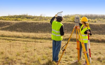
What are Geophysical Services?
Geophysical services are services that pertain to the collection, interpretation, and mapping of the physical properties of the surface and subsurface (below-ground) of an area. Some of the properties measured include gravity, magnetics, seismic refraction/reflection,...
What are Mining Services?
Mining services are typically defined in two different ways. The first is for physical mining operations, which includes the extraction of minerals, metals, and other material from the earth for industrial and commercial use. Mining services can also be defined as...