
In these environments, geophysical surveys, particularly magnetic and gravity methods, often provide the first meaningful insight into what lies beneath the surface. Long before a drill rig is mobilized, geophysics helps exploration teams understand structure, geology, and target potential while managing cost and risk.
The Reality of Exploring in Canada
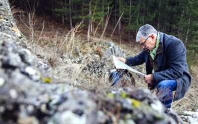
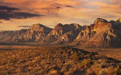
Mineral exploration in Canada is rarely simple. Many prospective regions are remote, infrastructure is limited, and access windows can be short. In northern and sub-arctic areas, field seasons may be constrained to just a few months each year. In other regions, thick overburden, glacial till, volcanic cover, or sedimentary basins obscure bedrock geology entirely.
These conditions make traditional exploration approaches such as extensive trenching or early drilling both expensive and risky. Each drillhole represents a significant financial and logistical commitment, particularly when mobilization requires helicopters, winter roads, or remote camps.
As a result, Canadian exploration programs place a strong emphasis on gathering high-quality subsurface information early in the project lifecycle. This is where geophysical surveys become key.
Why Geophysics Is Often the First Step in Canadian Projects
Geophysical surveys allow exploration teams to collect meaningful geological data without disturbing the ground. They can be deployed across large areas, often before full site access is available, and they work effectively in terrains where surface geology offers few clues.
In Canada, magnetic and gravity surveys are commonly used at the earliest stages of exploration because they help answer foundational questions:
- Where are the major structures and faults?
- What lithologies are present beneath cover?
- Are there intrusive bodies or dense rock units associated with mineralization?
- How does the geology change across large, underexplored areas?
By addressing these questions early, geophysics helps teams focus their time, budget, and drilling on the most prospective targets.
Magnetic Surveys in Canada’s Remote Exploration Settings
Magnetic surveys are particularly well suited to Canadian geology. Much of the country’s mineral endowment is associated with mafic and ultramafic rocks, greenstone belts, iron formations, and structurally complex terrains, all of which produce distinctive magnetic signatures.
In remote regions, airborne magnetic surveys are often the most practical way to gather regional data. Aircraft can cover hundreds or thousands of square kilometers quickly, mapping variations in the Earth’s magnetic field that reflect changes in rock type and structure. These surveys are commonly used to outline greenstone belts, trace fault systems, identify intrusive complexes, and define broad geological domains beneath cover.
Once regional trends are identified, higher-resolution ground magnetic surveys can be deployed in focused areas. These surveys add detail, helping geologists refine structural interpretations, map subtle faulting, and better understand the geometry of magnetic units that may control mineralization.
In covered or heavily vegetated terrains, magnetic data often provides the clearest picture of bedrock geology available before drilling.
Gravity Surveys Beneath Cover and Across Basins
While magnetic surveys respond to magnetic minerals, gravity surveys measure changes in rock density, making them especially valuable in parts of Canada where geology is concealed beneath thick cover or sedimentary basins.
Gravity surveys are frequently used to:
- Estimate depth to basement beneath sedimentary or volcanic cover
- Identify dense intrusive bodies associated with mineral systems
- Map basin architecture and structural offsets
- Distinguish between rock units with similar magnetic responses but different densities
In regions where surface mapping is limited, gravity data helps exploration teams understand the broader geological framework. This context is critical for deciding where to focus follow-up work, particularly when drilling costs are high and access is limited.
In remote Canadian settings, gravity surveys often complement magnetic data by adding an additional layer of subsurface insight, helping to reduce ambiguity and improve confidence in target selection.
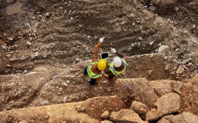
Reducing Risk and Cost in Challenging Canadian Environments
One of the most important roles of geophysical surveys in Canadian exploration is risk reduction. When access is difficult and drilling is expensive, every decision matters.
Magnetic and gravity surveys help exploration teams:
- Screen large areas efficiently before committing to detailed work
- Prioritize targets with geological support rather than drilling blind
- Reduce the number of unnecessary drillholes
- Make better use of short field seasons
- Plan logistics more effectively by focusing on high-value zones
In practical terms, this often means fewer mobilizations, more efficient drill programs, and a stronger technical basis for exploration decisions.
Geophysics as a Planning Tool, Not Just a Technical One
In Canada’s remote and covered terrains, geophysical surveys are planning tools. The information they provide influences everything from budget allocation to field logistics and drilling strategy.
By integrating magnetic and gravity data early, exploration teams gain a clearer understanding of their project area long before boots are on the ground. This clarity supports smarter sequencing of work, better coordination between disciplines, and more defensible decision-making as projects advance.
Final Thoughts
Canada’s mineral potential is vast, but unlocking it requires approaches that acknowledge the realities of remote terrain, limited access, and geological cover. Magnetic and gravity surveys have become foundational tools in Canadian mineral exploration because they deliver critical subsurface insight efficiently, safely, and cost-effectively.
Whether mapping regional structure, interpreting geology beneath cover, or refining drill targets in challenging environments, geophysical surveys help exploration teams reduce uncertainty and move forward with confidence.

ABOUT THE AUTHOR
BRIAN GOSS
President, Rangefront Mining Services
Brian Goss brings over 20 years of experience in gold and mineral exploration. He is the founder and President of Rangefront, a premier geological services and mining consulting company that caters to a large spectrum of clients in the mining and minerals exploration industries. Brian is also a director of Lithium Corp. (OTCQB: LTUM), an exploration stage company specializing in energy storage minerals and from 2014 to 2017, he fulfilled the role of President and Director of Graphite Corp. (OTCQB: GRPH), an exploration stage that specialized in the development of graphite properties. Prior to founding Rangefront, Brian worked as a staff geologist for Centerra Gold on the REN project, as well as various exploration and development projects in the Western United States and Michigan. Brian Goss holds a Bachelor of Science Degree with a major in Geology from Wayne State University in Michigan.
You may also be interested in...
What Types of Geology Jobs are Available in the Mining Industry?
For individuals with a geology degree, finding a job in the mining industry can be a great way to directly use geology expertise while being out in the field. While some geologists enjoy lab work or teaching, many geologists prefer to be outdoors, exploring and taking...

Mining Career Guide 2024
ARE MINING JOBS IN DEMAND? Mining jobs are in demand, as the need for minerals continues rising while skilled workers to fill these openings are difficult to find. Metal ore mining jobs are expected to grow by 16.3% over the next 10 years, which is higher than the...
Why Canada Has So Many Mining Companies
Canada is renowned for its stunning natural landscapes, friendly people, and a rich cultural tapestry. However, it's also a global leader in an industry that's not always in the spotlight but plays a significant role in the nation's economy: mining. WHAT MAKES CANADA...
Geophysical Surveys: Purposes & Cost
A geophysical survey is a non-invasive method of studying the subsurface properties of the Earth by measuring various physical properties, such as magnetic, seismic, and gravitational properties. These surveys are commonly conducted to gain insights into the...

Geophysical Surveys: Types of Surveys & Use Cases
Geophysical services refer to a branch of geological consulting that provides surveys and reporting to gather, interpret, and map geophysical data. These services are typically used for measuring, analyzing, and optimizing resources for mining or geology, and can also...

Mining & Mineral Exploration: Differences & Common Misconceptions
Mining and mineral exploration are a high-risk, high-reward process, requiring a high level of expertise, research, and—sometimes—a little luck. While many mineral exploration efforts never result in actual mining production operations, those that do can be highly...
Rangefront Mining Services Expands Local Field Crew Team to Washington State
Rangefront welcomes Daniel Reiss to the Rangefront team to head our new Washington state-based field crew, an expansion that will reduce already affordable costs for field crew services in the Northwest territories. July 2023 Elko, NV---Rangefront welcomes Daniel...

Geologists in the Mining Industry: Common Jobs & Career Outlook
Geology and the mining industry are naturally associated because of the expertise required to find and analyze potential deposits in bedrock. Because of that, many seeking a degree in geology will have their sights set on career opportunities in the mining industry,...

Common Challenges Mining Consultants Help Resolve
Utilizing a mining consultant during the mining and exploration process is an integral part of most operations’ strategies. As well as maximizing value and operational performance, a mining consultant can help shape strategy, drive innovation, and mitigate risks from...
5 Examples of Mineral Exploration
Mineral exploration is one of the first steps that takes place in a prospector’s journey from mineral discovery to active mining. This can be a long and resource-intensive process, but the payoffs can be significant. In mineral exploration, the goal is to investigate...
What Do Mining Consultants Do?
A successful mining project takes careful planning, expertise, and execution. With increasing focus on environmental regulations, corporate responsibility, political pressure, and more, engaging a mining consultant has become a practical solution to navigating the...

What to Look for in a Mining Recruiting Company
As the weather starts to warm, mining companies are beginning to recruit to fill seasonal contract needs. While some mining companies may use direct recruitment efforts, it’s more common for mining and exploration companies to use a recruiting service. WHAT TO LOOK...