Geophysical services refer to a branch of geological consulting that provides surveys and reporting to gather, interpret, and map geophysical data. These services are typically used for measuring, analyzing, and optimizing resources for mining or geology, and can also be conducted for engineering, environmental, or other purposes.
MOST COMMON GEOPHYSICAL SURVEYS
There are several different geophysical surveys, all of which use different measurement methods to identify the geography, subsurface artifacts, mineral makeup, etc., of a target area. Knowing which is necessary for your project depends on the stage and scope of your project as well as the geophysical makeup of the territory you are surveying. Below, we discuss the different types of geophysical surveys and what they are used for.
MAGNETIC SURVEY
A magnetic survey is a geophysical survey used to measure and map variations in the Earth’s magnetic field. It uses highly sensitive magnetometers to detect changes in the magnetic properties of subsurface materials and geological features. These variations in magnetic intensity can be caused by different rock types, mineral deposits, or buried structures.
Magnetic surveys are typically used for mineral exploration, archaeology, environmental studies, and oil and gas exploration, as well as to help identify and characterize subsurface features and anomalies.
ELECTROMAGNETIC SURVEYS
Electromagnetic surveys are used to investigate subsurface properties by measuring the response of materials to electromagnetic fields. These surveys involve the transmission of electromagnetic waves into the ground or the surroundings then measuring the signals that are reflected or scattered back. Depending on the method used, electromagnetic surveys can provide information about the electrical conductivity or resistivity of subsurface materials.
This data can be valuable for a wide range of applications, including mineral exploration, groundwater mapping, environmental assessments, and locating buried objects or structures.
ELECTRICAL RESISTIVITY SURVEYS
Electrical resistivity surveys study the subsurface properties of the Earth by measuring the resistance of materials to the flow of electrical currents. In these surveys, electrodes are placed on or in the ground and a small electrical current is passed between them. The resulting voltage measurements are used to calculate the electrical resistivity of the subsurface materials.
Different materials, such as rocks, soils, and groundwater, have varying resistivity values. This means electrical resistivity surveys can provide information about the composition, moisture content, and other geological characteristics of a particular area.
Electrical resistivity surveys are commonly applied in environmental studies, groundwater exploration, engineering projects, and archaeological investigations to map subsurface features, detect anomalies, and assess the suitability of a location for various purposes.
INDUCED POLARIZATION
Induced polarization (IP) surveys investigate subsurface properties by measuring how certain materials respond to electrical currents. In IP surveys, an electrical current is injected into the ground through electrodes, and the voltage decay over time is measured. This type of geophysical survey focuses on the ability of subsurface materials to store and release electrical charge. Materials like minerals or porous rock formations with chargeable properties can exhibit delayed voltage decay, which provides valuable information about their presence and characteristics.
IP surveys are commonly used for mineral exploration, groundwater studies, and environmental investigation. They help geophysicists and researchers identify subsurface anomalies, detect mineral deposits, assess groundwater quality, and evaluate soil and rock properties.
SEISMIC SURVEYS
Seismic surveys generate seismic waves using controlled sources, then record these waves using geophones or seismometers. In reflection seismic surveys, seismic waves are directed into the ground and bounce back (reflect) off subsurface interfaces (e.g., rock layers or faults). By recording the time it takes for these reflections to return and their amplitudes, geophysicists can create detailed images of the subsurface, revealing the layering and geometry of geological formations.
Refraction seismic surveys measure how seismic waves travel through the subsurface and change direction (refract) when they encounter different geological materials. By analyzing the travel times and angles of refraction, geophysicists can determine subsurface velocities and the depth of geological boundaries.
Seismic surveys help in identifying potential natural resource deposits (like oil, gas, and minerals), evaluating earthquake hazards, assessing groundwater aquifers, and making informed decisions in civil engineering and infrastructure projects. By interpreting seismic data, geoscientists can create subsurface models that aid in resource exploration, environmental studies, and risk assessment.
Final Thoughts
Determining the right geophysical survey for your needs is not only a matter of what will be most effective, but also what is most productive and economical for your project stage. If you’re not sure which geophysical survey is right for your project stage and scope, feel free to reach out and one of our technical service experts will be happy to help.

ABOUT THE AUTHOR
BRIAN GOSS
President, Rangefront Mining Services
Brian Goss brings over 20 years of experience in gold and mineral exploration. He is the founder and President of Rangefront, a premier geological services and mining consulting company that caters to a large spectrum of clients in the mining and minerals exploration industries. Brian is also a director of Lithium Corp. (OTCQB: LTUM), an exploration stage company specializing in energy storage minerals and from 2014 to 2017, he fulfilled the role of President and Director of Graphite Corp. (OTCQB: GRPH), an exploration stage that specialized in the development of graphite properties. Prior to founding Rangefront, Brian worked as a staff geologist for Centerra Gold on the REN project, as well as various exploration and development projects in the Western United States and Michigan. Brian Goss holds a Bachelor of Science Degree with a major in Geology from Wayne State University in Michigan.
You may also be interested in...
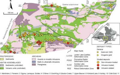
Mineral Exploration in the Abitibi Greenstone Belt: Geology, Deposit Types, and What to Expect in the Field
Image Source: https://www.sciencedirect.com/science/article/abs/pii/S016913682100247X The Abitibi Greenstone Belt produced more gold than almost any other Archean terrane on Earth, and the ground is still generating discovery-stage programs across northern Ontario and...
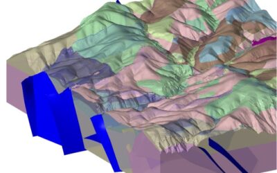
Beyond the Borehole: How 3D Geotechnical Modeling is De-Risking Modern Mine Design
The difference between a viable project and a costly oversight lies in the "digital twin" of the subsurface. Traditional 2D cross-sections, once the industry standard, are no longer sufficient for the complexities of modern resource extraction and the stringent safety...

Starting a Geology Career in Mining and Mineral Exploration
Graduating with a geology degree opens doors, but it can be hard to know which ones to walk through first. Many new graduates want work that's hands-on, technically meaningful, and connected to real projects, but translating that into an actual job search takes some...
Soil Sampling vs. Magnetic vs. Gravity Surveys in Canada’s Covered Terrain
Canada is home to some of the world’s most promising mineral districts, but many of those opportunities lie beneath cover rather than in clean, exposed outcrops. Across much of the country, exploration teams work in terrain shaped by glaciation, transported...

2026 Regulatory Shifts in Geophysics & Geotechnical Reporting in Canada
For Canadian junior and major exploration firms, the "Qualified Person" (QP) is under more scrutiny than ever. As we move into 2026, the integration of geophysical data into NI 43-101 technical reports has evolved from "supplemental" to "essential." In an era of...
How Geophysical Surveys Support Mineral Exploration in Canada’s Remote and Covered Terrains
Canada is one of the most mineral-rich countries in the world, but much of that potential lies in places that are difficult, expensive, or logistically complex to explore. From vast stretches of the Precambrian Shield to sediment-covered basins and northern regions...

Gravity Surveys in Mineral Exploration: How They Work, What They Reveal, and Why They Matter
In mineral exploration, every decision hinges on understanding what lies beneath the surface before drilling begins. Gravity surveys provide a precise, cost-effective way to map subsurface density variations and uncover geological structures that may host valuable...

Why Magnetic and Gravity Surveys Are Essential for Mineral Exploration in Canada
Canada is one of the most geophysically explored countries in the world. With vast mineral potential spread across the Precambrian Shield, structurally complex greenstone belts, sedimentary basins, and remote northern terrains, Canadian exploration has long relied on...

Magnetic Surveys in Mineral Exploration: How They Work, What They Show, and Why They Matter
Magnetic surveys, commonly known as mag surveys, are one of the most valuable and widely used geophysical tools in mineral exploration. They provide rapid, cost-effective insight into subsurface geology by measuring variations in the Earth’s magnetic field. These...

The 2026 Mining Career Handbook: Roles, Salaries, and How to Build a Future in a Changing Industry
The mining industry has entered a defining decade. As the world transitions toward clean energy and critical mineral demand surges, career opportunities in mining are expanding across every level from field crew operators to geoscientists, engineers, and project...

Free GPR Feasibility Checklist: Is Your Site Suitable for Ground-Penetrating Radar Scanning?
Ground-Penetrating Radar (GPR) is a powerful, non-invasive subsurface imaging tool that plays a critical role in industries ranging from construction and environmental consulting to archaeology and mineral exploration. In mineral exploration and mining, GPR can help...

Mining in British Columbia: Opportunities and Challenges
British Columbia (BC) is one of the world’s most geologically rich and mining-friendly regions. Known for its vast mineral wealth and complex terrain, BC is home to some of Canada’s most productive mining operations. This article explores mining in British Columbia,...